

原始文件 (SVG文件,尺寸为800 × 550像素,文件大小:111 KB)
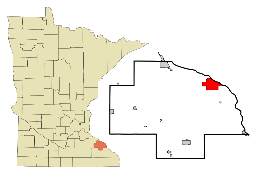
| 描述Wabasha County Minnesota Incorporated and Unincorporated areas Wabasha Highlighted.svg | This map shows the incorporated and unincorporated areas in Wabasha County, Minnesota, highlighting Wabasha in red. It was created with a custom script with US Census Bureau data and modified with Inkscape. |
| 日期 | |
| 来源 | My own work, based on public domain information. Based on similar map concepts by Ixnayonthetimmay |
| 作者 | Arkyan |
 | 已授权您依据自由软件基金会发行的无固定段落及封面封底文字(Invariant Sections, Front-Cover Texts, and Back-Cover Texts)的GNU自由文件许可协议1.2版或任意后续版本的条款,复制、传播和/或修改本文件。该协议的副本请见“GNU Free Documentation License”。http://www.gnu.org/copyleft/fdl.htmlGFDLGNU Free Documentation Licensetruetrue |
| 本文件采用知识共享署名-相同方式共享 3.0 未本地化版本许可协议授权。 | ||
| ||
| 本许可协议标签作为GFDL许可协议更新的组成部分被添加至本文件。http://creativecommons.org/licenses/by-sa/3.0/CC BY-SA 3.0Creative Commons Attribution-Share Alike 3.0truetrue |
点击某个日期/时间查看对应时刻的文件。
| 日期/时间 | 缩略图 | 大小 | 用户 | 备注 | |
|---|---|---|---|---|---|
| 当前 | 2007年10月17日 (三) 20:35 | | 800 × 550(111 KB) | ArkyBot~commonswiki | {{Information |Description=This map shows the incorporated and unincorporated areas in Wabasha County, Minnesota, highlighting Wabasha in red. It was c |
以下页面使用本文件:
以下其他wiki使用此文件: