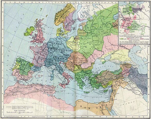
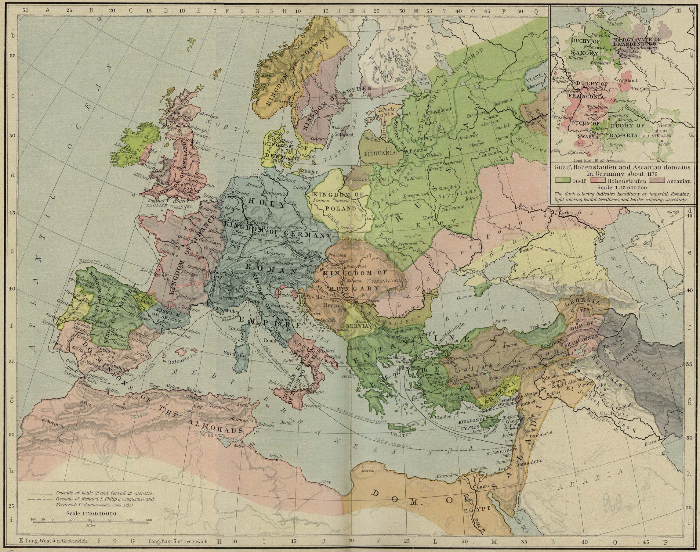
File:Europe mediterranean 1190.jpg

本预览的尺寸:760 × 600像素。 其他分辨率:304 × 240像素 | 608 × 480像素 | 973 × 768像素 | 1,280 × 1,010像素 | 2,293 × 1,810像素。
原始文件 (2,293 × 1,810像素,文件大小:834 KB,MIME类型:image/jpeg)
摘要
| 描述 | Europa en 1190. |
| 日期 | |
| 来源 | Perry-Castañeda Library, Map Collection: From the "Historical Atlas" by William R. Shepherd, New York, Henry Holt and Company, 1923 |
| 作者 | Roke |
| 其他版本 | العربيَّة |
.jpg)
.jpg)
_en.png)
.png)
.jpg)
许可协议
本作品在其来源国以及其他著作权期限是作者逝世后70年或以下的国家和地区属于公有领域。 | |
| 本文件已被确认为免除已知的著作权法限制(包括所有相关权利)。 | |
文件历史
点击某个日期/时间查看对应时刻的文件。
| 日期/时间 | 缩略图 | 大小 | 用户 | 备注 | |
|---|---|---|---|---|---|
| 当前 | 2011年5月28日 (六) 15:46 | | 2,293 × 1,810(834 KB) | Reddi~commonswiki | |
| 2006年5月8日 (一) 10:30 |  | 2,293 × 1,810(667 KB) | Roke~commonswiki | Europe in 1190 {{Europe}} {{PD-PCL|http://www.lib.utexas.edu/maps/historical/shepherd/europe_mediterranean_1190.jpg}} Category: Historical maps of Europe |
文件用途
全域文件用途
以下其他wiki使用此文件:
- azb.wikipedia.org上的用途
- az.wikipedia.org上的用途
- be.wikipedia.org上的用途
- bn.wikibooks.org上的用途
- ca.wikipedia.org上的用途
- cs.wikipedia.org上的用途
- cy.wikipedia.org上的用途
- da.wikipedia.org上的用途
- de.wikipedia.org上的用途
- el.wikipedia.org上的用途
- en.wikipedia.org上的用途
- en.wikibooks.org上的用途
- eo.wikipedia.org上的用途
- es.wikipedia.org上的用途
- et.wikipedia.org上的用途
查看此文件的更多全域用途。