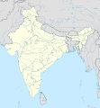
Fayl:India location map.svg

Size of this PNG preview of this SVG file: 557 × 600 piksel. Boshqa oʻlchamlari: 223 × 240 piksel | 446 × 480 piksel | 713 × 768 piksel | 951 × 1 024 piksel | 1 902 × 2 048 piksel | 1 500 × 1 615 piksel.
Asl fayl (SVG fayl, asl oʻlchamlari 1 500 × 1 615 piksel, fayl hajmi: 1,23 MB)
Fayl tarixi
Faylning biror paytdagi holatini koʻrish uchun tegishli sana/vaqtga bosingiz.
| Sana/Vaqt | Miniatura | Oʻlchamlari | Foydalanuvchi | Izoh | |
|---|---|---|---|---|---|
| joriy | 09:24, 4-Aprel 2021 |  | 1 500 × 1 615 (1,23 MB) | TKsdik8900 | Fulfilling the edit request (File talk:India location map.svg#Upload more compact version of India location map) by C1MM |
| 16:50, 14-Oktyabr 2020 |  | 1 500 × 1 615 (1,64 MB) | NordNordWest | correct Telangana/Andhra Pradesh | |
| 23:10, 3-Noyabr 2019 |  | 1 500 × 1 615 (1,62 MB) | RaviC | slight colour change for consistency | |
| 23:06, 3-Noyabr 2019 |  | 1 500 × 1 615 (1,62 MB) | RaviC | == {{int:filedesc}} == {{Information |Description={{en|Location map of India. Equirectangular projection. Strechted by 106.0%. Geographic limits of the map: * N: 37.5° N * S: 5.0° N * W: 67.0° E * E: 99.0° E Made with Natural Earth. Free vector and raster map data @ naturalearthdata.com.}} |Source={{own}} |Date=2010-02-20 |Author={{user at project|Uwe Dedering|wikipedia|de}} |Permission= |other_versions={{DerivativeVersions|India location map2.svg|India location map 3.png}} {{Other versions/I... | |
| 21:42, 19-Avgust 2014 |  | 1 500 × 1 615 (1,59 MB) | M0tty | Update by Sémhur : add the state of Telangana | |
| 11:51, 7-Iyun 2011 |  | 1 500 × 1 615 (1,49 MB) | NordNordWest | Nagaland corrected | |
| 16:10, 18-Yanvar 2011 |  | 1 500 × 1 615 (2,36 MB) | Uwe Dedering | Reverted to version as of 15:50, 17 January 2011 and again, layer structure destroyed, and first discuss this! | |
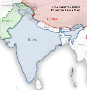
| 19:04, 17-Yanvar 2011 |  | 1 500 × 1 615 (1,52 MB) | AshwiniKalantri | The disputed land of Kashmir are shown in a different shade. | |
| 15:50, 17-Yanvar 2011 |  | 1 500 × 1 615 (2,36 MB) | Uwe Dedering | Reverted to version as of 11:34, 22 September 2010 vandalism | |
| 23:30, 16-Yanvar 2011 |  | 1 500 × 1 615 (2,01 MB) | AshwiniKalantri | {{Information |Description=Location Map of India |Source= |Date= |Author= |Permission= |other_versions= }} |
Fayllarga ishoratlar
More than 100 pages use this file.The following list shows the first 100 pages that use this file only.A full list is available.
- Amanganj
- Amaravati
- Ambada
- Amritsar tumani
- Bada Malhera
- Badagaon
- Badwara
- Bahoriband
- Baihar
- Balaghat
- Baldeogarh
- Bamhani
- Bansatar Kheda
- Barigarh
- Barkuhi
- Bharveli
- Bhedaghat
- Bhopal
- Bijawar
- Bilpura (Madhya Pradesh)
- Bohani
- Buxwaha
- Chandameta-Butaria
- Chandla
- Chhatarpur
- Damoh
- Damua
- Deodara
- Deori (Sagar)
- Devendranagar
- Dhana
- Dhimarkheda
- Dighawani
- Dongar Parasia
- Firozpur tumani
- Gangtok shahri
- Garhi-Malhara
- Ghuwara
- Godhavi
- Gwarighat
- Harpalpur
- Harrai
- Hatta (Madhya Pradesh)
- Hindistondagi koʻprik qulashi
- Hindoria
- Jatara
- Jaynagar Majilpur
- Jeron Khalsa
- Kakarhati
- Kari (Tikamgarh)
- Katni
- Khamaria (Jabalpur)
- Khargapur
- Lavkushnagar
- Lidhorakhas
- Lodhikheda
- Maharajpur (Madhya Pradesh)
- Majholi
- Mandla
- Manegaon (Madhya Pradesh)
- Mohgaon
- Morgan House, Kalimpong
- Mumbay
- Nainpur
- Narsinghgarh (Damoh)
- Nasik
- Nowgong (Chhatarpur)
- Nyu-Dehli
- Palera
- Panagar
- Panara (Madhya Pradesh)
- Pandhurna
- Panna (Hindiston)
- Patan (Madhya Pradesh)
- Patharia
- Pawai
- Pen (Hindiston)
- Pipariya (Jabalpur)
- Prithvipur
- Rahatgarh
- Raipura
- Rajnagar (Chhatarpur)
- Rehli
- Sagar (Madxya Pradesh)
- Sagar kantonmenti
- Satai
- Seoni (Madhya Pradesh)
- Sethia
- Shahgarh
- Shahpura (Jabalpur)
- Singhi Kangri
- Singrampur
- Sirgora
- Suhagi
- Taricharkalan
- Tendu Kheda
- Thiruvilwamala
- Tirodi
- Ukwa
- Vijayraghavgarh
View more links to this file.
Faylning global foydalanilishi
Ushbu fayl quyidagi vikilarda ishlatilyapti:
- ace.wikipedia.org loyihasida foydalanilishi
- af.wikipedia.org loyihasida foydalanilishi
- Leh
- Taj Mahal
- Amritsar
- Sjabloon:Liggingkaart Indië
- Indore
- Thane
- Bhopal
- Visakhapatnam
- Pimpri-Chinchwad
- Vadodara
- Ghaziabad
- Ludhiana
- Nashik
- Faridabad
- Meerut
- Rajkot
- Kalyan-Dombivali
- Vasai-Virar
- Srinagar
- Aurangabad
- Dhanbad
- Navi Mumbai
- Prayagraj
- Ranchi
- Haora
- Coimbatore
- Jabalpur
- Gwalior
- Vijayawada
- Jodhpur
- Madurai
- Raipur
- Kota
- Guwahati
- Chandigarh
- Solapur
- Hubli-Dharwad
- Indiese nasionale krieketspan
- Tiruchirappalli
- Thiruvananthapuram
- Krieketwêreldbeker 1987
- Krieketwêreldbeker 1996
- Krieketwêreldbeker 2011
- Krieketwêreldbeker 2023
- Jaynagar Majilpur
- Wes-Ghats
- Kushok Bakula Rimpochee Lughawe
Ushbu faylni koʻproq global foydalanishdan koʻring.
Metama’lumot
🔥 Top keywords: Bosh SahifaAndoza:Seks ishchi (orden)Maxsus:SearchUEFA Yevro 2024Jinsiy aloqaAllohning 99 nomiAmir TemurIMGSRC.RUHisorak suv omboriOʻzbekistonYunon-Baqtriya podsholigiAnora (film)Bemorni parvarish qilishAvestoSaraton (kasallik)HayzAlisher NavoiyXufton namoziOʻzbekiston tarixiQurbon hayitiBolgariyaTugʻruqUndosh tovushlarMuhammadSuvchechakHaj: Jannat onalar oyog‘i ostidaAnal jinsiy aloqaIztopar afsonasiMovarounnahrErkak jinsiy aʼzosiXorazmEva ElfieQovunchi madaniyatiShavkat MirziyoyevInna lillahi va inna ilayhi rojiʼunQunut duosiJaloliddin ManguberdiKoreya RespublikasiBobur


