File:San Andreas Fault Aerial View.gif
No higher resolution available.
San_Andreas_Fault_Aerial_View.gif (300 × 439 pixels, file size: 82 KB, MIME type: image/gif)
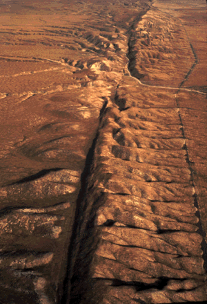
| Description | English: An aerial view of the San Andreas Fault in the Carrizo Plain, Central California |
| Date | eergister ofzo |
| Source | http://pubs.usgs.gov/gip/earthq1/how.html |
| Author | USGS |
| Permission (Reusing this file) | PD |
This image is in the public domain in the United States because it only contains materials that originally came from the United States Geological Survey, an agency of the United States Department of the Interior. For more information, see the official USGS copyright policy. |
File history
Click on a date/time to view the file as it appeared at that time.
| Date/Time | Thumbnail | Dimensions | User | Comment | |
|---|---|---|---|---|---|
| current | 15:30, 26 July 2006 | | 300 × 439 (82 KB) | Cave cattum | {{Information| |Description = An aerial view of the San Andreas fault in the Carrizo Plain, Central California |Source = http://pubs.usgs.gov/gip/earthq1/how.html |Date = |Author = USGS |Permission = PD |other_versions = }} {{PD-USGov-Interior-USGS}} [[ |
File usage
The following page uses this file:
Global file usage
The following other wikis use this file:
- Usage on ar.wikipedia.org
- Usage on ast.wikipedia.org
- Usage on ca.wikipedia.org
- Usage on cs.wikipedia.org
- Usage on cs.wikiversity.org
- Usage on cy.wikipedia.org
- Usage on de.wikipedia.org
- Usage on en.wikipedia.org
- Usage on en.wikiversity.org
- Usage on fr.wikipedia.org
- Usage on fr.wiktionary.org
- Usage on ga.wikipedia.org
- Usage on he.wikipedia.org
- העתק
- ויקיפדיה:הידעת?/סדרה 2/יולי
- ויקיפדיה:הידעת?/סדרה 1/יולי
- פורטל:גאולוגיה/הידעת?/קטעי הידעת
- תבנית:הידעת? 13 ביולי - סדרה 1
- פורטל:ספורט/הידעת?/קטעי הידעת
- ויקיפדיה:הידעת?/דיונים/מיזם היובל/הצבעה
- פורטל:גאולוגיה/הרכב ותכונות/תכונות נבחרות
- פורטל:גאולוגיה/מבנה ותכונות/11
- קמט (גאולוגיה)
- תבנית:הידעת? 13 ביולי 2012
- ויקיפדיה:הידעת?/2012/יולי
- משתמש:Meni yuzevich/העמוד הראשי של אתמול
- משתמש:Meni yuzevich//הידעת?
- ויקיפדיה:הידעת?/2015/יולי
- תבנית:הידעת? 15 ביולי 2015
- ויקיפדיה:הידעת?/2017/יולי
- תבנית:הידעת? 18 ביולי 2017
- התצפית העמוקה של שבר סן אנדראס
- תבנית:הידעת? 10 ביולי 2020
- ויקיפדיה:הידעת?/2020/יולי
- פורטל:ארצות הברית/הידעת?/קטעי הידעת? - 2
- פורטל:ארצות הברית/הידעת?/108
- פורטל:ספורט/הידעת?/61
- פורטל:משחקים/הידעת?/אוסף
- פורטל:משחקים/הידעת?/20
- פורטל:גאולוגיה/הידעת?/25
- ויקיפדיה:הידעת?/2022/יולי
- תבנית:הידעת? 13 ביולי 2022
- ויקיפדיה:הידעת?/2024/יולי
- תבנית:הידעת? 13 ביולי 2024
- Usage on hi.wikipedia.org
- Usage on hu.wikipedia.org
- Usage on id.wikipedia.org
- Usage on it.wikipedia.org
View more global usage of this file.
🔥 Top keywords: Main PageSpecial:SearchSupreme Court of the United StatesList of UEFA European Championship finalsWikipedia:AboutList of U.S. statesHelp:ContentsHelp:IntroductionKnights of the Round TableList of Disney moviesBlackSpecial:RecentChangesGodzilla X Kong: The New EmpireList of people who have walked on the MoonList of U.S. states and territories by time zoneUnited StatesThe Garfield MovieEducation24-hour clockEid al-AdhaGolden EdgeQueen (band)List of countries by continentsAviciiBig Mac IndexAdolf Hitler UunonaUmro Ayyar - A New BeginningMurder of Junko FurutaHelp:Authority controlCristiano RonaldoBismillahir Rahmanir Raheem19 Kids and CountingSOLID (object-oriented design)Jude BellinghamXXXTentacionLisa SparxxxPeriodic tableList of fruitsBTS