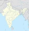
Vaizdas:India location map.svg

Rinkmenos SVG peržiūros PNG dydisː 557 × 600 taškų. Kitos 6 rezoliucijos: 223 × 240 taškų | 446 × 480 taškų | 713 × 768 taškų | 951 × 1 024 taškų | 1 902 × 2 048 taškų | 1 500 × 1 615 taškų.
Didesnės raiškos iliustracija (SVG rinkmena, formaliai 1 500 × 1 615 taškų, rinkmenos dydis: 1,23 MiB)
Rinkmenos istorija
Paspauskite ant datos/laiko, kad pamatytumėte rinkmeną tokią, kokia ji buvo tuo metu.
| Data/Laikas | Miniatiūra | Matmenys | Naudotojas | Paaiškinimas | |
|---|---|---|---|---|---|
| dabartinis | 12:24, 4 balandžio 2021 |  | 1 500 × 1 615 (1,23 MiB) | TKsdik8900 | Fulfilling the edit request (File talk:India location map.svg#Upload more compact version of India location map) by C1MM |
| 19:50, 14 spalio 2020 |  | 1 500 × 1 615 (1,64 MiB) | NordNordWest | correct Telangana/Andhra Pradesh | |
| 02:10, 4 lapkričio 2019 |  | 1 500 × 1 615 (1,62 MiB) | RaviC | slight colour change for consistency | |
| 02:06, 4 lapkričio 2019 |  | 1 500 × 1 615 (1,62 MiB) | RaviC | == {{int:filedesc}} == {{Information |Description={{en|Location map of India. Equirectangular projection. Strechted by 106.0%. Geographic limits of the map: * N: 37.5° N * S: 5.0° N * W: 67.0° E * E: 99.0° E Made with Natural Earth. Free vector and raster map data @ naturalearthdata.com.}} |Source={{own}} |Date=2010-02-20 |Author={{user at project|Uwe Dedering|wikipedia|de}} |Permission= |other_versions={{DerivativeVersions|India location map2.svg|India location map 3.png}} {{Other versions/I... | |
| 00:42, 20 rugpjūčio 2014 |  | 1 500 × 1 615 (1,59 MiB) | M0tty | Update by Sémhur : add the state of Telangana | |
| 14:51, 7 birželio 2011 |  | 1 500 × 1 615 (1,49 MiB) | NordNordWest | Nagaland corrected | |
| 19:10, 18 sausio 2011 |  | 1 500 × 1 615 (2,36 MiB) | Uwe Dedering | Reverted to version as of 15:50, 17 January 2011 and again, layer structure destroyed, and first discuss this! | |
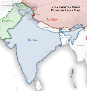
| 22:04, 17 sausio 2011 |  | 1 500 × 1 615 (1,52 MiB) | AshwiniKalantri | The disputed land of Kashmir are shown in a different shade. | |
| 18:50, 17 sausio 2011 |  | 1 500 × 1 615 (2,36 MiB) | Uwe Dedering | Reverted to version as of 11:34, 22 September 2010 vandalism | |
| 02:30, 17 sausio 2011 |  | 1 500 × 1 615 (2,01 MiB) | AshwiniKalantri | {{Information |Description=Location Map of India |Source= |Date= |Author= |Permission= |other_versions= }} |
Paveikslėlio naudojimas
Daugiau nei 100 puslapių naudoja šią rinkmeną.Šis sąrašas rodo tik pirmus 100 puslapių, naudojančių šį failą.Yra pasiekiamas ir visas sąrašas.
- Adonis (Indija)
- Adžantos olos
- Adžmeras
- Agartala
- Agra
- Ahmadabadas
- Ahmadnagaras
- Aizavlis
- Ajodhija
- Akola
- Alapuža
- Aligarhas
- Almora
- Alvaras (Indija)
- Ambala
- Amravatis
- Amrelis
- Amritsaras
- Amroha
- Asansolas
- Aurangabadas
- Bandipuro nacionalinis parkas
- Baranagaras
- Bardhamanas
- Bareli
- Belaris
- Bengalūras
- Bhagalpuras
- Bhimbetkos olų būstai
- Bhopalas
- Bhubanešvaras
- Dardžilingas
- Dehradūnas
- Delis
- Dharamšala
- Didžioji Noida
- Dispuras
- Džabalpuras
- Džaipuras
- Džamalpuras (Indija)
- Džamu
- Eloros olos
- Faridabadas
- Fatehpur Sikris
- Gandhinagaras
- Gangtokas
- Gaziabadas
- Guvahatis
- Haidarabadas (Indija)
- Haura
- Humajūno kapavietė
- Imphalis
- Indauras
- Itanagaras
- Kaljanas (miestas)
- Kanpuras
- Kavaratis
- Khadžurahas
- Kohima
- Kolkata
- Kočinda (Indija)
- Kočis (Indija)
- Kutbo minaretas
- Laknau
- Lehas
- Ludhiana
- Madurajus
- Mahabodhio šventykla
- Miratas
- Mumbajus
- Nagpuras
- Naujasis Delis
- Našikas
- Panadžis
- Pataliputra
- Patna
- Pimpris-Činčvadas
- Port Bleras
- Prajagradžas
- Puna (Indija)
- Radžkotas
- Raipuras
- Rančis
- Sančis
- Senoji Goa
- Silvasa
- Sionas (Indija)
- Stok Kangris
- Suratas
- Thanė
- Tiruvanantapuramas
- Vadodara
- Varanasis
- Višakhapatnamas
- Čandigarchas
- Čenajus
- Čerapundžis
- Šilongas
- Šimla
- Šrinagaras
Žiūrėti daugiau nuorodų į šį failą.
Visuotinis rinkmenos naudojimas
Ši rinkmena naudojama šiose viki svetainėse:
- Naudojama ace.wikipedia.org
- Naudojama af.wikipedia.org
- Leh
- Taj Mahal
- Amritsar
- Sjabloon:Liggingkaart Indië
- Indore
- Thane
- Bhopal
- Visakhapatnam
- Pimpri-Chinchwad
- Vadodara
- Ghaziabad
- Ludhiana
- Nashik
- Faridabad
- Meerut
- Rajkot
- Kalyan-Dombivali
- Vasai-Virar
- Srinagar
- Aurangabad
- Dhanbad
- Navi Mumbai
- Prayagraj
- Ranchi
- Haora
- Coimbatore
- Jabalpur
- Gwalior
- Vijayawada
- Jodhpur
- Madurai
- Raipur
- Kota
- Guwahati
- Chandigarh
- Solapur
- Hubli-Dharwad
- Indiese nasionale krieketspan
- Tiruchirappalli
- Thiruvananthapuram
- Krieketwêreldbeker 1987
- Krieketwêreldbeker 1996
- Krieketwêreldbeker 2011
- Krieketwêreldbeker 2023
- Jaynagar Majilpur
- Wes-Ghats
- Kushok Bakula Rimpochee Lughawe
Žiūrėti visuotinį šios rinkmenos naudojimą.
Meta duomenys
🔥 Top keywords: Pagrindinis puslapisSpecialus:PaieškaSpecialus:Naujausi keitimaiLietuvaSąrašas:Europos Sąjungos valstybės narėsJoninėsZodiakasUEFA Europos futbolo čempionatasXVII Europos futbolo čempionatasFIFA pasaulio čempionatasVilniusKylian Mbappé2024 m. vasaros olimpinės žaidynėsRumunijaLietuvių kalbos abėcėlėSąrašas:Šalių telefonų kodai pagal šalies pavadinimąSlovakijaMonika NavickienėEuropos SąjungaSąrašas:Lietuvos miestai pagal gyventojusSmegenysXVI Europos futbolo čempionatasPrancūzijos vyrų futbolo rinktinėSąrašas:Šalių sąrašasCarles PuigdemontMindaugas KuzminskasSąrašas:Zarasų rajono ežeraiRomelu LukakuJAV valstijosBelgijaFutbolasLietuvos nacionalinis radijas ir televizijaSidabriškieji debesysFIFA pasaulio reitingaiOzzy OsbournePetras GražulisVikipedija:BendruomenėAntrasis pasaulinis karasRemigijus Morkevičius


