

Original file (SVG file, nominally 1,047 × 1,251 pixels, file size: 151 KB)
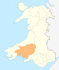
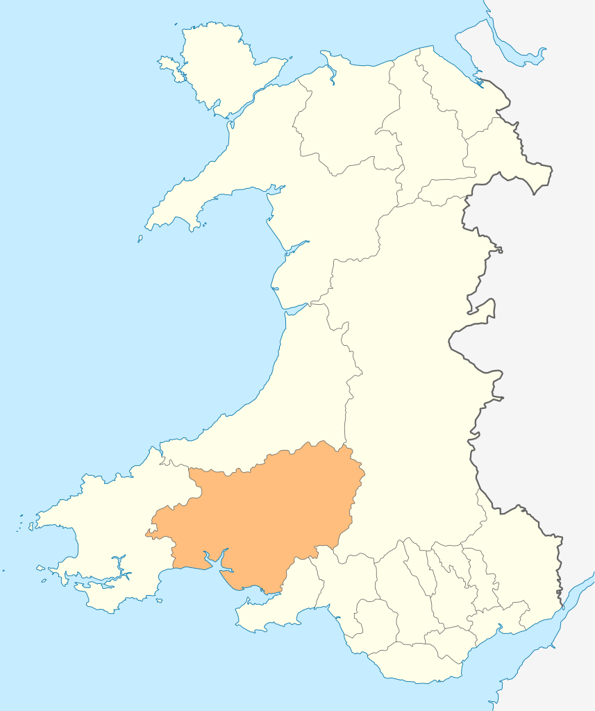
| DescriptionWales Carmarthenshire locator map.svg | Deutsch: Lagekarte von Carmarthenshire in Wales English: Locator map of Carmarthenshire in Wales |
| Date | |
| Source | Own work |
| Author | NordNordWest |
| Permission (Reusing this file) | I, the copyright holder of this work, hereby publish it under the following license: This file is licensed under the Creative Commons Attribution-Share Alike 3.0 Unported license.
|
 | This map has been made or improved in the German Kartenwerkstatt (Map Lab). You can propose maps to improve as well. azərbaycanca ∙ čeština ∙ Deutsch ∙ Deutsch (Sie-Form) ∙ English ∙ español ∙ français ∙ italiano ∙ latviešu ∙ magyar ∙ Nederlands ∙ Plattdüütsch ∙ polski ∙ português ∙ română ∙ sicilianu ∙ slovenščina ∙ suomi ∙ македонски ∙ русский ∙ ქართული ∙ հայերեն ∙ বাংলা ∙ ไทย ∙ +/− |
Click on a date/time to view the file as it appeared at that time.
| Date/Time | Thumbnail | Dimensions | User | Comment | |
|---|---|---|---|---|---|
| current | 18:49, 4 May 2010 | | 1,047 × 1,251 (151 KB) | NordNordWest | {{int:filedesc}} {{Information |Description= {{de|Lagekarte von Carmarthenshire in Wales}} {{en|Locator map of Carmarthenshire in Wales}} |Source={{Own}} |Date=2010-05-04 |Author={{U|NordNordWest}} |Permission={{self|cc-by-sa-3.0}} |other_versions= }} {{ |
More than 100 pages use this file.The following list shows the first 100 pages that use this file only.A full list is available.
View more links to this file.
The following other wikis use this file:
View more global usage of this file.