

Original file (SVG file, nominally 3,974 × 2,563 pixels, file size: 277 KB)
| Camera location | 38° 58′ 36″ N, 117° 47′ 07″ E | View this and other nearby images on: OpenStreetMap |
|---|
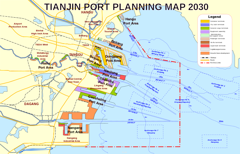
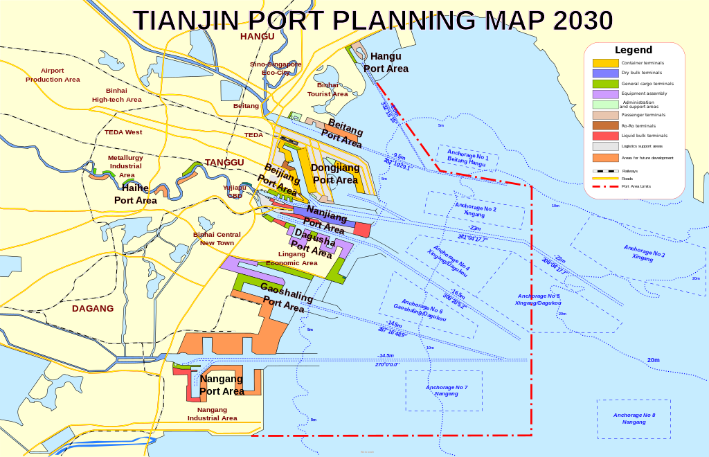
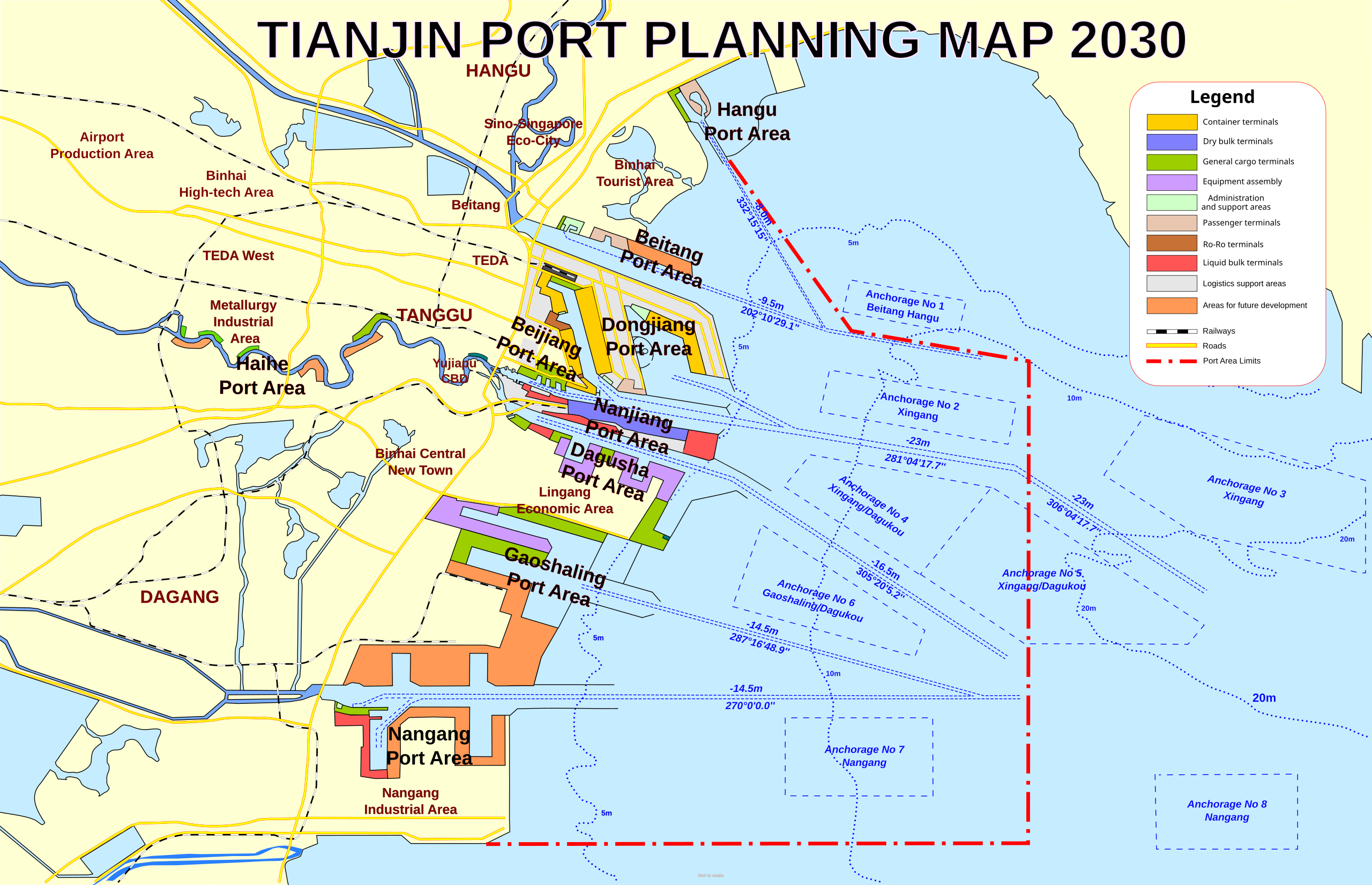
| DescriptionTianjin Port Planning Map 2030.svg | English: Planning map of the projected extension of the Port of Tianjin in 2030, based on the 2010 plans. Includes terminal facilities, shipping channels and anchorages, and major roads and railways. |
| Date | |
| Source | Own work |
| Author | Arrorro |
Click on a date/time to view the file as it appeared at that time.
| Date/Time | Thumbnail | Dimensions | User | Comment | |
|---|---|---|---|---|---|
| current | 05:47, 6 September 2012 | | 3,974 × 2,563 (277 KB) | Arrorro | Color scheme tweak |
| 04:04, 30 August 2012 |  | 3,974 × 2,563 (275 KB) | Arrorro | User created page with UploadWizard |
The following other wikis use this file:
This file contains additional information, probably added from the digital camera or scanner used to create or digitize it.
If the file has been modified from its original state, some details may not fully reflect the modified file.
| Short title | Tianjin Port Planning Map 2030 |
|---|---|
| Width | 3974.1897 |
| Height | 2562.5959 |