
Mosaic_at_MountNebo.jpg (800 × 600 pixels, file size: 277 KB, MIME type: image/jpeg)
| Camera location | 31° 46′ 04.79″ N, 35° 43′ 32.8″ E | View this and other nearby images on: OpenStreetMap |
|---|
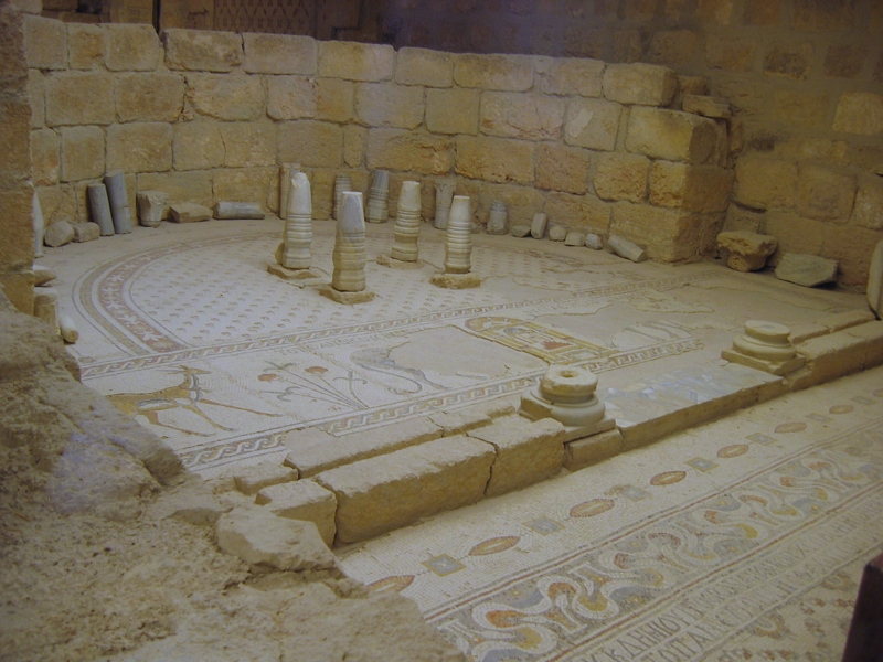
| DescriptionMosaic at MountNebo.jpg | Mosaic at the church on Mount Nebo : the Theotokos ("Mother of God") Chapel. |
| Date | |
| Source | Own work |
| Author | DuiMDog |
 | Permission is granted to copy, distribute and/or modify this document under the terms of the GNU Free Documentation License, Version 1.2 or any later version published by the Free Software Foundation; with no Invariant Sections, no Front-Cover Texts, and no Back-Cover Texts. A copy of the license is included in the section entitled GNU Free Documentation License.http://www.gnu.org/copyleft/fdl.htmlGFDLGNU Free Documentation Licensetruetrue |
Click on a date/time to view the file as it appeared at that time.
| Date/Time | Thumbnail | Dimensions | User | Comment | |
|---|---|---|---|---|---|
| current | 15:41, 25 November 2007 | | 800 × 600 (277 KB) | Duimdog | {{Information |Description=mosaic at the church on Mount Nebo |Source=own work |Date=2007-10-14 |Author=DuiMDog |Permission= |other_versions= }} |
The following other wikis use this file:
This file contains additional information, probably added from the digital camera or scanner used to create or digitize it.
If the file has been modified from its original state, some details may not fully reflect the modified file.
| Image title | IMG_6788.JPG |
|---|---|
| Camera manufacturer | 257784 |
| Author | it: <a href="http://www.robogeo.com/Flickr2Map/%22>Google Earth</a> | <a href=" |
| Exposure time | 43,781/2 sec (21,890.5) |
| F-number | f/0.0012029479839201 |
| Lens focal length | 1,684.4487179487 mm |
| User comments | Mosaic floor at the church on Mount Nebo (Jordan)Map it: <a href="http://www.robogeo.com/Flickr2Map/%22>Google Earth</a> | <a href="http://www.robogeo.com/Flickr2Map/?type=map%22 target="_blank">Street</a> | <a href="http://www.robogeo.com/Flickr2Map/?type=map&view=satellite%22 target="_blank">Satellite</a> | <a href="http://www.robogeo.com/Flickr2Map/?type=map&view=hybrid%22 target="_blank">Hybrid</a> | <a href="http://www.robogeo.com/Flickr2Map/?type=nautical%22 target="_blank">Nautical</a> |
| Latitude | 31° 46′ 4.79″ N |
| Longitude | 35° 43′ 32.8″ E |
| Altitude | 702.007 meters above sea level |
| Headline | IMG_6788.JPG |
| Orientation | Normal |
| Vertical resolution | 0.954217572905 dpi |
| Software used | loor at the chu |
| Y and C positioning | Centered |
| Exif version | 2.21 |
| Meaning of each component |
|
| Image compression mode | 0.00097509446227603 |
| Shutter speed | 0.5 |
| APEX aperture | 4,692.0357142857 |
| Exposure bias | 0.001522324894579 |
| Maximum land aperture | 0.087719298245614 APEX (f/1.03) |
| Metering mode | Pattern |
| Flash | Flash did not fire, compulsory flash suppression |
| DateTime subseconds | 765 |
| Supported Flashpix version | 1 |
| Color space | sRGB |
| Focal plane X resolution | 1 |
| Focal plane resolution unit | inches |
| Sensing method | One-chip color area sensor |
| File source | Digital still camera |
| Custom image processing | Normal process |
| Exposure mode | Auto exposure |
| White balance | Auto white balance |
| Digital zoom ratio | 0.00018310919364242 |
| Scene capture type | Standard |
| GPS time (atomic clock) | 11:51 |
| Geodetic survey data used | WGS 1984 |
| GPS date | 14 October 2007 |
| GPS tag version | 0.0.2.2 |
| IIM version | 4 |
| Keywords |
|