
Original file (1,247 × 1,136 pixels, file size: 1.42 MB, MIME type: image/png)
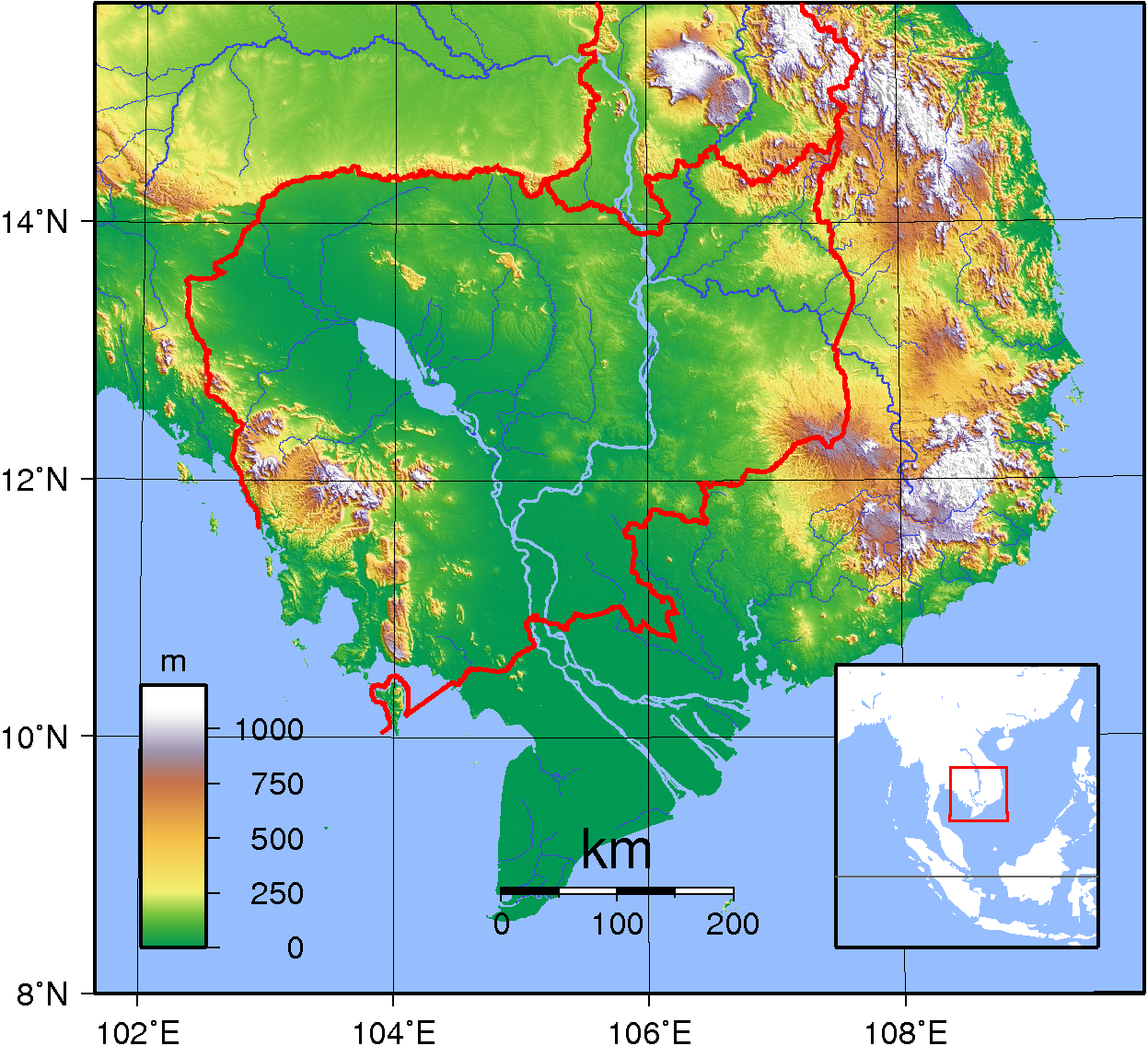
| DescriptionCambodia Topography.png | Topographic map of Cambodia. Created with GMT from publicly released GLOBE data.[1] |
| Date | |
| Source | Own work |
| Author | Sadalmelik |
| Public domainPublic domainfalsefalse |
| This work has been released into the public domain by its author, I, Sadalmelik. This applies worldwide. In some countries this may not be legally possible; if so: I, Sadalmelik grants anyone the right to use this work for any purpose, without any conditions, unless such conditions are required by law. |
Click on a date/time to view the file as it appeared at that time.
| Date/Time | Thumbnail | Dimensions | User | Comment | |
|---|---|---|---|---|---|
| current | 10:00, 14 October 2007 | | 1,247 × 1,136 (1.42 MB) | Sadalmelik | Better data, nicer colours |
| 19:18, 11 June 2007 |  | 1,222 × 1,053 (967 KB) | Sadalmelik | {{Information |Description=Topographic map of Cambodia. Created with GMT from publicly released GLOBE data.[http://www.ngdc.noaa.gov/mgg/topo/globe.html] |Source=self-made |Date=June 11, 2007 |Author= Sadalmelik }} [[Category:Maps of |
The following other wikis use this file: