
پروندهٔ اصلی (۹۰۰ × ۸۵۸ پیکسل، اندازهٔ پرونده: ۶۴۶ کیلوبایت، نوع MIME پرونده: image/png)
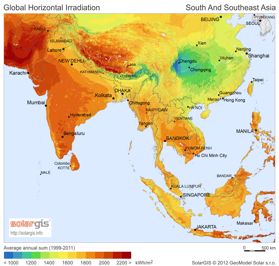
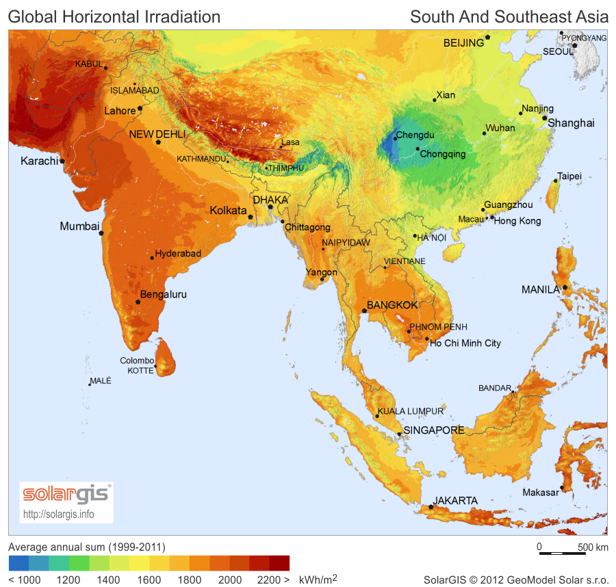
| توضیحSolarGIS-Solar-map-South-And-South-East-Asia-en.png | English: Solar Radiation Map: Global Horizontal Irradiation Map of South and Southeast Asia, SolarGIS. |
| تاریخ | |
| منبع | Image linked from free download page |
| پدیدآور | SolarGIS © 2012 GeoModel Solar |
| اجازهنامه (استفادهٔ مجدد از این پرونده) | The maps are free for public use, their reproduction and adaptation is authorised provided the following source is acknowledged:SolarGIS © 2014 GeoModel SolarBy downloading a free map, you acknowledge that GeoModel Solar retains all rights, titles, and interest in the information provided by the maps, including the copyright, SolarGIS logo and all other intellectual property rights, and that GeoModel Solar has the right to make these maps available under Creative Commons Attribution-ShareAlike 3.0 Unported License. GeoModel Solar makes no representations or warranties about the accuracy, reliability, completeness or suitability for any particular purpose of the free maps. You agree that GeoModel Solar is under no liability for any loss or damage (including consequential damage) that you may suffer from the use of the free maps. |
روی تاریخ/زمانها کلیک کنید تا نسخهٔ مربوط به آن هنگام را ببینید.
| تاریخ/زمان | بندانگشتی | ابعاد | کاربر | توضیح | |
|---|---|---|---|---|---|
| کنونی | ۳۰ آوریل ۲۰۱۷، ساعت ۲۱:۳۳ | | ۹۰۰ در ۸۵۸ (۶۴۶ کیلوبایت) | Ayane m | 30 KB file size reduction |
| ۱ سپتامبر ۲۰۱۴، ساعت ۱۷:۲۰ |  | ۹۰۰ در ۸۵۸ (۶۷۷ کیلوبایت) | Rfassbind | {{Information |Description={{en|1=Solar Radiation Map: Global Horizontal Irradiation Map of South and Southeast Asia, SolarGIS.}} |Source=[http://solargis.info/doc/_pics/freemaps/1000px/ghi/SolarGIS-Solar-map-South-And-South-East-Asia-en.png Image] lin... |
صفحهٔ زیر از این تصویر استفاده میکند:
ویکیهای دیگر زیر از این پرونده استفاده میکنند: