The Northeastern United States or simply the Northeast is a region of the United States as defined by the United States Census Bureau.[1]
Definition
The U.S. Census Bureau defines the region as comprising nine states: the New England states of Connecticut, Maine, Massachusetts, New Hampshire, Rhode Island and Vermont; and the Mid-Atlantic states of New Jersey, New York and Pennsylvania.[2] The Census Bureau regions are "widely used...for data collection and analysis."[3][4][5] Not all definitions of the Northeastern United States, however, are the same as the Census Bureau's.[6][7] For example, colloquial definitions of the Northeast may include parts of Delaware, Maryland, and the District of Columbia.[8][9][10][11][12][13][14]
Geography

The Northeastern United States is bounded to the northwest by Canada, to the southeast by the Atlantic Ocean, to the south by the American South, and to the west by the American Midwest. The Census-defined region occupies a total area of 181,324 sq mi (469,630 km2), making it slightly larger than Sweden.[15][16]
Topography
In the Mid-Atlantic region, the Atlantic coastal plain extends southward from the New York Bight into New Jersey, and the Piedmont runs from northern New Jersey through southeastern Pennsylvania.[17][18] The Fall Line, which crosses through Paterson, New Jersey, Trenton, New Jersey, and Philadelphia, marks the boundary between the Atlantic coastal plain and Piedmont.[19][20] The Appalachian Mountains extend across inland regions of New England and the Mid-Atlantic. Historically, the Appalachians presented a significant barrier to east-west land travel in the Northeast because of their steep valleys and ridges.[21][22]
According to the United States Geological Survey, the Appalachian Highlands physiographic division can be divided into the New England province, Piedmont, Blue Ridge Mountains, Ridge-and-Valley, Appalachian Plateau, Adirondack, and St. Lawrence Valley physiographic provinces.[18][23] The New England province consists of a plateau-like upland in New England that gradually rises inland from the coast and slopes to maximum altitudes of 2,200 feet (670 m).[24] The Blue Ridge Mountains extend south of Harrisburg, Pennsylvania into Maryland.[25] The Ridge-and-Valley province is characterized by parallel ridges, with rolling valleys in between, extending westward from southeastern New York through Pennsylvania.[26] The Appalachian Plateau stretches from southern New York across western Pennsylvania, forming the western part of the Appalachian mountains. The Allegheny Front, a rugged escarpment that forms part of the Eastern Continental Divide, separates the Appalachian Plateau and the Ridge-and-Valley provinces.[27] The Adirondack Mountains, located in northeastern New York, consist of a nearly circular dome of eroded peaks, either isolated or in groups.[28] Northwest of the Appalachians and Adirondacks, the Saint Lawrence River valley slopes downward toward the Saint Lawrence River, Lake Ontario, and Lake Erie.[18]
Mount Washington in New Hampshire is the highest peak in the Northeastern United States and the second-highest peak in the Appalachian Mountain system, at 6,288 feet (1,917 m).[29] It is the site of the second highest recorded wind speed on Earth,[30][31] and has the reputation of having the world's worst weather.[29][32]
Climate
Under the Köppen climate classification scheme, the majority of the Northeast lies within the humid continental climate region (Dfa or Dfb).[33] In addition, portions of the Mid-Atlantic region occupy the northern periphery of the humid subtropical climate region (Cfa), including New York City,[33][34][35] Philadelphia,[33] and parts of New Jersey.[33][36] The region has four distinct seasons, with temperatures ranging from warm to hot in the summer to below 32 °F (0 °C) in the winter.[37] The New England region has bright and colorful "fall foliage", and a seasonal tourist industry has grown up around the few weeks in autumn when the leaves are at their peak.
Especially during the winter,[38] the region can experience "nor'easters", which can produce flooding, gale force winds, beach erosion, and blizzards.[39][40] The storm, a type of extratropical cyclone, is named because the winds over coastal areas blow from a northeasterly direction and the storm travels to the northeast.[40] The strongest effects of the storm reach the major coastal cities of the Northeast.[40] Hurricanes, tornadoes, and earthquakes can occur but are rare.[41][42][43]
History
All of the states in the Northeast were among the original Thirteen Colonies, though Maine and Vermont were considered part of other colonies at the time.
New England

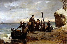
The first Europeans to settle New England were Pilgrims from England, who landed in present-day Massachusetts in 1620.[44] The Pilgrims arrived by the Mayflower and founded Plymouth Colony so they could practice religion freely.[44] Ten years later, a larger group of Puritans settled north of Plymouth Colony in Boston to form Massachusetts Bay Colony.[45] In 1636, the colonies of Connecticut and Providence were established.[46][47] Providence was founded by Roger Williams, who was banished by Massachusetts for his beliefs in freedom of religion, and it was the first colony to guarantee all citizens freedom of worship.[47] Anne Hutchinson, who was also banished by Massachusetts, formed the town of Portsmouth.[47] Providence, Portsmouth, and two other towns consolidated to form the Colony of Rhode Island and Providence Plantations.[47]
New England played a prominent role in early American education, literature, and philosophy. Starting in the 17th century, the larger towns in New England opened grammar schools, the forerunner of the modern high school. The most famous was the Boston Latin School, which was founded in 1635 as the first public school in the English colonies.[48] In 1636, the colonial legislature of Massachusetts founded Harvard College, the oldest institution of higher learning in the United States.[49]
In the late 18th century, the New England Colonies initiated the resistance to the British Parliament's efforts to impose new taxes without the consent of the colonists. The Boston Tea Party was a protest that angered Great Britain, which responded with the "Intolerable Acts", stripping the colonies of self-government. The confrontation led to open warfare in 1775, the expulsion of the British from New England in spring 1776, and the Declaration of Independence in July 1776.
Mid-Atlantic
Since colonial times, the region was home to a wider variety of European cultures. Henry Hudson explored the area of present-day New York in 1609 and claimed it for the Dutch. His journey stimulated Dutch interest, and the area became known as New Netherland. In 1625, the city of New Amsterdam (the location of present-day New York City) was designated the capital of the province.[50] The Dutch New Netherland settlement along the Hudson River and, for a time, the New Sweden settlement along the Delaware River divided the English settlements in the north and the south. In 1664, Charles II of England formally annexed New Netherland and incorporated it into the English colonial empire.[51] The territory became the colonies of New York and New Jersey.[51] New Jersey was originally split into East Jersey and West Jersey until the two were united as a royal colony in 1702.[51] In 1681, William Penn, who wanted to give Quakers a land of religious freedom, founded Pennsylvania and extended freedom of religion to all religions.[52]
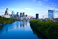
Philadelphia was the meeting place of the Founding Fathers of the United States, who signed the Declaration of Independence on July 4, 1776 and adopted the United States Constitution on September 17, 1787.
Culture
Religion
While some regions of the United States are predominantly Protestant, four states in the Northeast are more than 40% Roman Catholic, with Rhode Island having the highest percentage of Catholics in the Continental United States.[53] This is largely due to immigrantion from Catholic regions such as Ireland, Italy, Quebec, and Latin America.[54][55]
The Northeast has the largest concentration and percentage of Jews in the United States. New York City is home to nearly 1.1 million Jews,[56] and the New York City area is home to the largest Jewish community outside Israel.[57] The region also has the most Hindus and Sikhs in the nation. This is because the Northeast has more people of Indian descent than any other part of the country, and in the world outside India.
Although the first settlers of New England were motivated by religion, New England has become one of the most irreligious parts of the United States. In a 2009 Gallup survey, less than 50% of residents in Vermont, New Hampshire, Maine, and Massachusetts viewed religion as an important part of their daily life.[58] In a 2010 Gallup survey, less than 30% of residents in Vermont, New Hampshire, Maine, and Massachusetts reported attending church weekly, giving them the lowest church attendance among U.S. states.[59]
Ethnic diversity

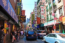
The Northeast is one of the most ethnically diverse regions in the United States.
Cuisine
The New England cuisine is characterized by extensive use of seafood and dairy products.
Cuisine of New England: clam chowder, baked beans, lobster, Apple cider, Apple pie
The cuisine of the Mid-Atlantic states has been influenced by the region's immigrant population.
New York City cuisine: Hot dogs, Manhattan clam chowder, New York-style pizza, Italian Ice, Ice Cream Cone
Philadelphia cuisine: cheesesteak, hoagie, soft pretzel, scrapple, tasty cake, water ice
Media
Accents
Sports
Politics
The Northeast region is known for its liberal, progressive politics. For example, every state in the region voted for John Kerry in the 2004 presidential election. Pennsylvania, however, is considered a state that either a Republican or Democratic presidential candidate could win.
Historical
Present
Economy
The Northeast is the wealthiest region of the United States. In 2007, the wealthiest states included New Jersey (second), Connecticut (third), and Massachusetts (fifth), according to the U.S. Census Bureau. New York alone accounts for nearly 8 percent of U.S. gross domestic product (GDP) as of 2005.
Until World War II, the economy of the Northeast was largely driven by industry. The Northeast's rapid industrialization followed the British Industrial Revolution, starting in 1789 when Samuel Slater emigrated from England to Rhode Island in hopes of making a fortune. Slater, known as the "Father of the American Industrial Revolution", opened the first American water-powered textile mill in 1793 with a design that replicated a British model.
New York City has the largest regional economy in the United States and the second largest city economy in the world after Tokyo.[65] Anchored by Wall Street, New York City is the financial capital of the United States and one of the world's two premier financial centers, alongside London.[66][67][68][69][70] New York City is home to the New York Stock Exchange and NASDAQ, the world's largest stock exchanges by market capitalization and trading activity.
Education
Colleges and universities

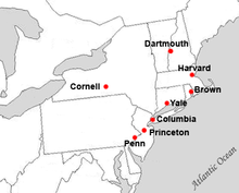
The Northeast is home to the eight Ivy League institutions: Brown University, Columbia University, Cornell University, Dartmouth College, Harvard University, Princeton University, the University of Pennsylvania, and Yale University. Although the term Ivy League was coined to describe an athletic conference,[71][72] the phrase has connotations of academic prestige, selectivity in admissions, and social elitism.[73] The U.S. News and World Report ranks all eight Ivy League schools rank within the top fifteen colleges and universities in the United States.[74] Seven of the Ivy League schools, in addition to Rutgers University (formerly named Queen's College), were chartered before the United States became a sovereign nation.[75]. The Northeast is also home to the Massachusetts Institute of Technology, which is considered one of the top universities nationally and globally,[76][77][78][79] and Carnegie Mellon University, which consistently ranks among the top 25 universities in the nation.[74][80]
The region contains the "Little Ivies", an informal group of old, academically elite liberal arts colleges comparable to the Ivy League. Although the term is sometimes synonymous with the "Little Three"—Amherst, Wesleyan, and Williams[81][82][83]—the term can also refer to schools of the modern-day New England Small College Athletic Conference.[84][85] The schools of the "Seven Sisters", historically women's colleges, are also in the Northeast.[86][87]
Demography


The region accounts for approximately 25% of U.S. gross domestic product as of 2007.[88] As of the 2010 Census, the population of the region totaled 55,317,240.[89]
| Rank | Metropolitan Area | State(s) and/or Territory | 2010 Census Population |
|---|---|---|---|
| 1 | New York | CT, NJ, NY | 18,897,109 |
| 2 | Philadelphia | DE, MD, NJ, PA | 5,965,343 |
| 3 | Boston | MA, NH, RI | 4,552,402 |
| 4 | Pittsburgh | PA | 2,356,285 |
| 5 | Providence | MA, RI | 1,600,852 |
| 6 | Hartford | CT | 1,212,381 |
| 7 | Buffalo | NY | 1,135,509 |
| 8 | Rochester | NY | 1,054,323 |
| Rank | City | State(s) and/or Territory | 2010 Census Population |
|---|---|---|---|
| 1 | New York City | NY | 8,175,133 |
| 2 | Philadelphia | PA | 1,526,006 |
| 3 | Boston | MA | 617,594 |
| 4 | Pittsburgh | PA | 305,704 |
| 5 | Newark | NJ | 277,140 |
| 6 | Buffalo | NY | 261,310 |
| 7 | Jersey City | NJ | 247,597 |
| 8 | Rochester | NY | 210,565 |
| 9 | Yonkers | NY | 195,976 |