Santol, officially the Municipality of Santol (Ilocano: Ili ti Santol; Filipino: Bayan ng Santol), is a 4th class municipality in the province of La Union, Philippines. According to the 2020 census, it has a population of 14,166 people.[3]
Santol | |
|---|---|
| Municipality of Santol | |
 Welcome arch | |
 Flag  Seal | |
| Motto: Isem Metru Santol | |
 Map of La Union with Santol highlighted | |
OpenStreetMap  | |
.svg) Santol Location within the Philippines | |
| Coordinates: 16°46′N 120°27′E / 16.77°N 120.45°E | |
| Country | Philippines |
| Region | Ilocos Region |
| Province | La Union |
| District | 1st district |
| Barangays | 11 (see Barangays) |
| Government | |
| • Type | Sangguniang Bayan |
| • Mayor | Magno A. Wailan |
| • Vice Mayor | Monico A. Oriente Jr. |
| • Representative | Pablo C. Ortega |
| • Municipal Council | Members |
| • Electorate | 9,587 voters (2022) |
| Area | |
| • Total | 93.70 km2 (36.18 sq mi) |
| Elevation | 226 m (741 ft) |
| Highest elevation | 798 m (2,618 ft) |
| Lowest elevation | 17 m (56 ft) |
| Population (2020 census)[3] | |
| • Total | 14,166 |
| • Density | 150/km2 (390/sq mi) |
| • Households | 3,325 |
| Economy | |
| • Income class | 4th municipal income class |
| • Poverty incidence | 16.93 |
| • Revenue | ₱ 84.29 million (2020) |
| • Assets | ₱ 490.1 million (2020) |
| • Expenditure | ₱ 120 million (2020) |
| • Liabilities | ₱ 24.11 million (2020) |
| Service provider | |
| • Electricity | La Union Electric Cooperative (LUELCO) |
| Time zone | UTC+8 (PST) |
| ZIP code | 2505 |
| PSGC | |
| IDD : area code | +63 (0)72 |
| Native languages | Ilocano Tagalog |
| Website | www |
Geography
Santol is situated in the north-eastern part of the Province of La Union. It is bounded on the north by the Municipality of Sudipen, on the north-east by the upland Municipality of Sugpon in Ilocos Sur, on the south by the Municipality of San Gabriel, and on the west by the Municipality of Balaoan. The town center of Santol is 40 kilometres (25 mi) north of the City of San Fernando, the provincial capital and regional administrative center; 310 kilometres (190 mi) north of Manila and 113 kilometres (70 mi) of the country's summer capital Baguio via the Naguilian Road.
Barangays
Santol is politically subdivided into 11barangays. [5] Each barangay consists of puroks and some have sitios.
- Corrooy
- Lettac Norte
- Lettac Sur
- Mangaan
- Paagan
- Poblacion
- Puguil
- Ramot
- Sapdaan
- Sasaba
- Tubaday
Climate
| Climate data for Santol, La Union | |||||||||||||
|---|---|---|---|---|---|---|---|---|---|---|---|---|---|
| Month | Jan | Feb | Mar | Apr | May | Jun | Jul | Aug | Sep | Oct | Nov | Dec | Year |
| Mean daily maximum °C (°F) | 30 (86) | 31 (88) | 32 (90) | 33 (91) | 32 (90) | 31 (88) | 30 (86) | 29 (84) | 30 (86) | 31 (88) | 31 (88) | 30 (86) | 31 (88) |
| Mean daily minimum °C (°F) | 21 (70) | 22 (72) | 23 (73) | 25 (77) | 26 (79) | 25 (77) | 25 (77) | 25 (77) | 25 (77) | 24 (75) | 23 (73) | 21 (70) | 24 (75) |
| Average precipitation mm (inches) | 42 (1.7) | 48 (1.9) | 74 (2.9) | 110 (4.3) | 269 (10.6) | 275 (10.8) | 362 (14.3) | 325 (12.8) | 330 (13.0) | 306 (12.0) | 126 (5.0) | 61 (2.4) | 2,328 (91.7) |
| Average rainy days | 11.2 | 12.0 | 17.1 | 21.2 | 27.1 | 26.8 | 28.1 | 27.0 | 26.0 | 24.5 | 17.7 | 12.4 | 251.1 |
| Source: Meteoblue[6] | |||||||||||||
Demographics
| Year | Pop. | ±% p.a. |
|---|---|---|
| 1918 | 3,536 | — |
| 1939 | 4,901 | +1.57% |
| 1948 | 5,060 | +0.36% |
| 1960 | 6,125 | +1.60% |
| 1970 | 7,316 | +1.79% |
| 1975 | 7,686 | +0.99% |
| 1980 | 7,836 | +0.39% |
| 1990 | 9,544 | +1.99% |
| 1995 | 10,209 | +1.27% |
| 2000 | 11,202 | +2.01% |
| 2007 | 11,712 | +0.62% |
| 2010 | 12,007 | +0.91% |
| 2015 | 12,476 | +0.73% |
| 2020 | 14,166 | +2.53% |
| Source: Philippine Statistics Authority[7][8][9][10] | ||
In the 2020 census, the population of Santol, La Union, was 14,166 people,[3] with a density of 150 inhabitants per square kilometre or 390 inhabitants per square mile.
Economy
Poverty incidence of Santol
10 20 30 40 2006 39.70 2009 32.74 2012 20.64 2015 12.57 2018 5.31 2021 16.93 Source: Philippine Statistics Authority[11][12][13][14][15][16][17][18] |
Government
Local government
Santol, belonging to the first congressional district of the province of La Union, is governed by a mayor designated as its local chief executive and by a municipal council as its legislative body in accordance with the Local Government Code. The mayor, vice mayor, and the councilors are elected directly by the people through an election which is being held every three years.
Elected officials
| Position | Name |
|---|---|
| Congressman | Pablo C. Ortega |
| Mayor | Magno A. Wailan |
| Vice-Mayor | Monico O. Oriente Jr. |
| Councilors | Jojo O. Ominga |
| Claudio O. Galos Jr. | |
| Edith R. Millares | |
| William O. Agtarap | |
| Olympio O. Millares | |
| Loreto A. Wailan | |
| Roxanne M. Dangle | |
| Tirso A. Ledda |
Gallery
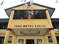 Municipal hall
 Town center
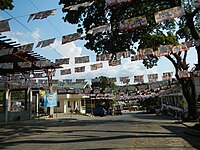 Town center
 Our Lady of Victory Church
 Street view and landscape


