Robles is a barrio in the municipality of Aibonito, Puerto Rico. Its population in 2010 was 3,863.[3][4][5]
Robles | |
|---|---|
Barrio | |
 Mountain view in Robles | |
 Location of Robles within the municipality of Aibonito shown in red | |
 Robles Location of Puerto Rico | |
| Coordinates: 18°08′00″N 66°14′20″W / 18.133408°N 66.238827°W[1] | |
| Commonwealth | |
| Municipality | |
| Area | |
| • Total | 5.31 sq mi (13.8 km2) |
| • Land | 5.31 sq mi (13.8 km2) |
| • Water | 0.00 sq mi (0.0 km2) |
| Elevation | 2,051 ft (625 m) |
| Population (2010) | |
| • Total | 3,863 |
| • Density | 727.5/sq mi (280.9/km2) |
| Source: 2010 Census | |
| Time zone | UTC−4 (AST) |
History
Robles was in Spain's gazetteers[6] until Puerto Rico was ceded by Spain in the aftermath of the Spanish–American War under the terms of the Treaty of Paris of 1898 and became an unincorporated territory of the United States. In 1899, the United States Department of War conducted a census of Puerto Rico finding that the combined population of Robles and Pasto barrios was 1,459.[7]
| Census | Pop. | Note | %± |
|---|---|---|---|
| 1910 | 1,171 | — | |
| 1920 | 1,357 | 15.9% | |
| 1930 | 1,763 | 29.9% | |
| 1940 | 1,621 | −8.1% | |
| 1950 | 1,801 | 11.1% | |
| 1960 | 1,925 | 6.9% | |
| 1970 | 2,049 | 6.4% | |
| 1980 | 3,101 | 51.3% | |
| 1990 | 4,916 | 58.5% | |
| 2000 | 4,566 | −7.1% | |
| 2010 | 3,863 | −15.4% | |
| U.S. Decennial Census 1900 (N/A)[8] 1910-1930[9] 1930-1950[10] 1980-2000[11] 2010[12] | |||
Sectors
Barrios (which are, in contemporary times, roughly comparable to minor civil divisions)[13] in turn are further subdivided into smaller locally populated place areas/units called sectores (sectors in English). The types of sectores may vary, from normally sector to urbanización to reparto to barriada to residencial, among others.[14][15][16]
The following sectors are in Robles barrio:[17]
Barrio Robles Centro, Calle Mercedita Serrallés, Carretera 722, Condominio Casa Aibonito, Desvío Robles, Extensión Bella Vista, Extensión San José, Hogar Aurora, Parcelas Rabanal, Poblado Muñoz Rivera, Reparto Robles, Residencial Liborio Ortiz, Residencial Villa Verde, Ruta Panorámica 7722, Sector Campito, Sector Concretera, Sector El Castillo, Sector La Base, Sector La Ceiba, Sector La Loma, Sector Mameyes, Sector Manresa, Sector Pangola, Sector Rabanal, Sector Represa, Sector Sierra, Tramo Calle San José (Carretera 14) Norte, Tramo Calle San José (Carretera 14) Sur, Urbanización Bella Vista, Urbanización Brisas de Aibonito, Urbanización Buena Vista, Urbanización Campo Rey, Urbanización La Providencia (Pangola), Urbanización Las Flores, Urbanización Las Mercedes, Urbanización Las Quintas, Urbanización Monte Carlo, Urbanización San José, Urbanización Villa Coquí, Urbanización Villa Rosales, and Villa Panorámica.
Gallery
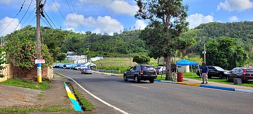 Puerto Rico Highway 722 in Robles
.jpg)
