Phra Nakhon Si Ayutthaya (Thai: พระนครศรีอยุธยา, pronounced [pʰráʔ ná(ʔ).kʰɔ̄ːn sǐː ʔā.jút.tʰā.jāː]; also spelled "Ayudhya"), or locally and simply Ayutthaya is the capital of Phra Nakhon Si Ayutthaya province of Thailand. Ayutthaya was the capital of the Ayutthaya Kingdom. Located on an island at the confluence of the Chao Phraya and Pa Sak rivers, Ayutthaya is the birthplace of the founder of Bangkok, King Rama I. The ruins of the old city are preserved in the Ayutthaya Historical Park.
Phra Nakhon Si Ayutthaya พระนครศรีอยุธยา Principality of Ayutthaya | |
|---|---|
| City of Phra Nakhon Si Ayutthaya เทศบาลนครพระนครศรีอยุธยา | |
 | |
Location in Thailand | |
| Coordinates: 14°20′52″N 100°33′38″E / 14.34778°N 100.56056°E | |
| Country | |
| Province | Phra Nakhon Si Ayutthaya |
| District | Phra Nakhon Si Ayutthaya |
| Named for | Ayodhya, Uttar Pradesh, India |
| Government | |
| • Type | City Municipality |
| • Mayor | Somsong Sappakosonlakul |
| Area | |
| • Total | 14.84 km2 (5.73 sq mi) |
| Population (2020) | |
| • Total | 50,830 |
| • Density | 3,400/km2 (8,900/sq mi) |
| Registered residents only | |
| Time zone | UTC+7 (ICT) |
| Postcode | 13xxx |
| Area code | (+66) 35 |
| Website | ayutthayacity.go.th/ |
Etymology

The name Ayutthaya is derived from Sanskrit अयोध्य - Ayodhya and is from the Thai national epic Ramakien; phra (from Khmer: preah ព្រះ ) is a prefix for a noun concerning a royal person, and nakhon (from Pali: nagara) designates an important or capital city.
History
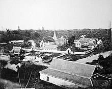
Prior to Ayutthaya's traditional founding date, archaeological and written evidence has revealed that Ayutthaya may have existed as early as the late 13th century as a water-borne port town. King Mongkut in an article written in the mid-19th century and published in Canton, China, notes:
I am just availing myself of an opportunity for searching into some pages of Siamese ancient history, and beg to state that our ancient capital Ayuthia before the year AD 1350, was but the ruin of an ancient place belonging to Kambuja (now known as Cambodia), formerly called Lawek... There were other cities not far remote, also possessed by the Kambujans...[2]
Further evidence of this can be seen with Wat Phanan Choeng, which was founded in 1324, 27 years before Ayutthaya's official foundation.[3]
Ayutthaya was officially founded in 1351[a] by King U Thong, who went there to escape a smallpox outbreak in Lopburi and proclaimed it the capital of his kingdom, often referred to as the Ayutthaya Kingdom or Siam. Ayutthaya became the second Siamese capital after Sukhothai.[4] It is estimated that Ayutthaya by the year 1600 had a population of about 300,000, with the population perhaps reaching 1,000,000 around 1700, making it one of the world's largest cities at that time,[5] when it was sometimes known as the "Venice of the East".[6][7]
In 1767, the city was destroyed by the Burmese army, resulting in the collapse of the kingdom. The ruins of the old city are preserved in the Ayutthaya historical park,[8] which is recognised internationally as a UNESCO World Heritage Site. The ruins, characterised by the prang (reliquary towers) and gigantic monasteries, give an idea of the city's past splendour.[9] Modern Ayutthaya was refounded a few kilometres to the east.
Population
Since 2005, the population of Ayutthaya has been declining.[10]
| Estimation date | 31 Dec 2005 | 31 Dec 2010 | 31 Dec 2015 | 31 Dec 2019 |
|---|---|---|---|---|
| Population | 55,097 | 54,190 | 52,940 | 50,830 |
Geography
The city is about 40 miles (64 km) north of Bangkok.[11]
Climate
Ayutthaya, located in the central plains, is affected by three seasons:
- Hot Season: March – May
- Rainy season: June – October
- Cool season: November – February
| Climate data for Ayutthaya | |||||||||||||
|---|---|---|---|---|---|---|---|---|---|---|---|---|---|
| Month | Jan | Feb | Mar | Apr | May | Jun | Jul | Aug | Sep | Oct | Nov | Dec | Year |
| Mean daily maximum °C (°F) | 31.6 (88.9) | 34.0 (93.2) | 36.7 (98.1) | 37.4 (99.3) | 36.8 (98.2) | 34.2 (93.6) | 33.8 (92.8) | 32.8 (91.0) | 32.3 (90.1) | 32.3 (90.1) | 32.0 (89.6) | 30.9 (87.6) | 33.7 (92.7) |
| Mean daily minimum °C (°F) | 18.4 (65.1) | 20.2 (68.4) | 24.4 (75.9) | 25.6 (78.1) | 26.4 (79.5) | 26.3 (79.3) | 25.5 (77.9) | 24.8 (76.6) | 24.4 (75.9) | 23.5 (74.3) | 21.6 (70.9) | 19.4 (66.9) | 23.4 (74.1) |
| Average rainfall mm (inches) | 2.4 (0.09) | 18.8 (0.74) | 43.5 (1.71) | 67.9 (2.67) | 208.0 (8.19) | 223.0 (8.78) | 180.8 (7.12) | 260.0 (10.24) | 213.9 (8.42) | 167.6 (6.60) | 37.1 (1.46) | 0.8 (0.03) | 1,423.8 (56.05) |
| Average rainy days | 0 | 1 | 4 | 6 | 15 | 16 | 17 | 19 | 17 | 12 | 3 | 1 | 111 |
| Source: Thai Meteorological Department[12] | |||||||||||||
Ayutthaya City Sites
Notable cultural sites
| Name | Picture | Built | Sponsor(s) | Notes |
|---|---|---|---|---|
| Wat Yai Chai Mongkhon |  | 1357[13] | King Ramathibodi I[14] | One of the most famous temples in Ayutthaya |
| Wat Mahathat | 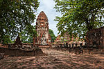 | 1374 | King Borommaracha I | |
| Wat Chai Watthanaram |  | 1630 | King Prasat Thong | One of the most famous temples in Ayutthaya |
| Wat Phanan Choeng |  | 1324 | ||
| Wat Phra Si Sanphet | 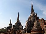 | 1350 | King Ramathibodi I | |
| Wihan Phra Mongkhon Bophit |  | c. 1637 (restored c. 1742/20th century, on multiple occasions)[15] | King Chairacha King Borommakot[16] | Restored once or twice in the 18th century. Reduced to ruins after the Fall of Ayutthaya in 1767. Restored in the 20th century.[17] |
| Wat Na Phra Men |  | 1503[18] | King Ramathibodi II | One of the best preserved temples to survive after the Fall of Ayutthaya in 1767. Restored during the reign of Rama III (r. 1824–51).[19] |
| Wat Ratchaburana | 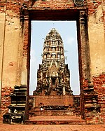 | 1424 | King Borommarachathirat II | |
| Wat Pradu Songtham | Under royal patronage from King Songtham (r. 1611–28) until the fall of Ayutthaya in 1767[20] | King Uthumphon entered the monkhood at this temple following his forced abdication in 1758[21] | ||
| Wat Lokaya Sutharam |  | 1452 | King Intharacha | |
| Wat Phra Ram | 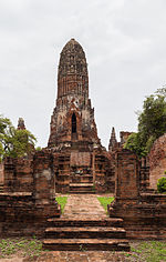 | 1369 | King Ramesuan | |
| Wat Phutthaisawan | 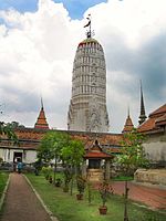 | Before 1350 | King Ramathibodi I | Built before Ayutthaya was founded |
| Chedi Phukhao Thong | 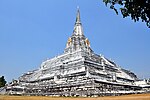 | c. 1569, 1587 (rebuilt in 1744)[22] | King (then-Prince) Naresuan King Borommakot[23] | Built to commemorate a battle victory following Ayutthaya's liberation from Burma in 1584[24] |
| Wat Thammikarat |  | Before 1350 | King of Lavo | Built before Ayutthaya was founded |
| Wat Kudi Dao |  | 1711 or earlier[25] | Prince, later King Borommakot[26] | A good example of 18th-century Late Ayutthaya wat architecture. Partially restored.[27] |
Museums
- Ayutthaya Historical Study Centre
- Chao Sam Phraya National Museum: The museum was specially display the objects excavated at Wat Racha Burana and Wat Maha That.
Other tourism sites

- Wang Luang
- Wat Suwan Dararam
- St. Joseph's Church
- Baan Hollanda
The city is located at the junction of the Chao Phraya, Lopburi and Pa Sak rivers, and on the main north–south railway linking Chiang Mai to Bangkok. The old city is on an island formed by a bend of the Chao Phraya on the west and south sides, the Pa Sak on the east side and the Klong Muang canal on the northern side.
The approximate centre of the old city is 14°20′N 100°34′E / 14.333°N 100.567°E.
Ayutthaya Night Market[28]
The market offers a plethora of shopping opportunities, including a wide variety of food, clothing, and handicrafts. Visitors can enjoy traditional Thai dishes such as pad Thai, mango sticky rice, and tom yum soup, as well as a range of international cuisine. The market is also famous for its impressive array of souvenirs, including handmade bags, jewelry, and textiles. The atmosphere is lively and energetic, with street performers, music, and colorful lights adding to the festive ambiance.
The Floating Market of Ayutthaya[29]
There is a lesser-known floating market in Ayutthaya called Klong Sabua which is more popular with Thai tourists than foreign travellers.
The main attraction is a Water Theatre, said to be the only one of its kind in Thailand, featuring live performances of Thai folk tales and Sepaa musicals.
Transport

Ayutthaya is accessible by air and rail.
Air
The closest airport is Bangkok's Don Mueang International Airport, a hub for regional budget carriers. An elevated walkway connects Terminal 1 to the Don Muang Train Station, where Ayutthaya-bound trains regularly roll through.[30]
Rail
Trains to Ayutthaya leave Bangkok's Hua Lamphong Station approximately every hour between 04:20 am. and 10:00 pm. The 3rd class fare is 20 baht for the 1.5 hour trip. Train schedules are available from the information booth at Hua Lamphong Station, Bangkok.[31]
In fiction
- A Thailand-themed town named "Ayothaya" appears in the personal computer MMORPG Ragnarok Online.
- Ayutthaya is a stage in Soul Calibur II.
- The temples in Wat Phra Si Sanphet and Wat Ratchaburana from Ayutthaya appear in Street Fighter II, Kickboxer (as "Stone City"), Mortal Kombat, Mortal Kombat Annihilation, and throughout Mortal Kombat Conquest.[32]
- The lying Buddha statue from the Ayutthaya ruins appears in Sagat's stage in most of the Street Fighter games.[33]
- It was featured in the 2005 movie "The King Maker".
- The 1630 destruction of the Japanese quarter of Ayutthaya at the orders of Prasat Thong and its consequences is central to one of the stories in the 1632 series anthology Ring of Fire III, "All God's Children in the Burning East" by Garrett W. Vance.
- In the 2010 Nintendo DS game Golden Sun: Dark Dawn, the main characters visit the city of 'Ayuthay', which draws heavily on Thai culture and architecture.
- A Thailand-themed map named "Ayutthaya" appears in the video game Overwatch.
- Ayutthaya was featured in the 2016 video game Civilization VI as a non-playable city-state, boosting culture point generation in whichever civilization it is currently allied with.
Gallery
- Elephants
- Elephant
- Buddhist monk in Ayutthaya
- Wat Phra Si Sanphet
- Mahathat, Ayutthaya historical park
- Floating market of Ayutthaya
- Thammikarat temple
- Ayutthaya city centre at night
Notes
a The city was founded on Friday, the 6th day of the waxing moon of the 5th month, 1893 Buddhist Era, corresponding to Friday, 4 March 1351 Common Era, according to the calculation of the Fine Arts Department of Thailand.[34]
See also
References
Further reading
- Stefan Halikowski Smith, Creolization and Diaspora in the Portuguese Indies: The Social World of Ayutthaya, 1640-1720 (Leiden, Brill, 2011) (European Expansion and Indigenous Response, 8).
External links


- http://www.ayutthaya.go.th/eng_travel.htm Website of municipality
 Ayutthaya travel guide from Wikivoyage


