This is a list of public art in the London Borough of Harrow.
Belmont
| Image | Title / subject | Location and coordinates | Date | Artist / designer | Type | Designation | Notes |
|---|---|---|---|---|---|---|---|
| Subway mural | Belmont Trail subway, near medical centre and St Joseph's Catholic Primary School 51°36′04″N 0°19′11″W / 51.6012°N 0.3198°W | 2012 | Harrow Arts Centre and Alistair Lambert working with St Joseph's Catholic Primary School | Mural | — | [1] |
Edgware
| Image | Title / subject | Location and coordinates | Date | Artist / designer | Type | Designation | Notes |
|---|---|---|---|---|---|---|---|
 | Edgware War Memorial | High Street 51°36′41″N 0°16′49″W / 51.6113°N 0.2802°W | 1920 | ? | Celtic cross | Grade II | Unveiled 27 March 1920.[2] |
Greenhill
| Image | Title / subject | Location and coordinates | Date | Artist / designer | Type | Designation | Notes |
|---|---|---|---|---|---|---|---|
 More images | Greenhill War Memorial | St John's churchyard 51°34′58″N 0°19′54″W / 51.58266°N 0.3318°W | 1951 | ? | Pillar | Grade II | [3] |
Harrow
| Image | Title / subject | Location and coordinates | Date | Artist / designer | Type | Designation | Notes |
|---|---|---|---|---|---|---|---|
 | Harrow Weald War Memorial | High Road, at junction with Box Tree Road 51°36′27″N 0°20′25″W / 51.6074°N 0.3404°W | 1917 | L. F. W. Deacon and J. C. Rackham | Street shrine | — | [4] |
 | Skipping Girl | St Ann's Road 51°34′53″N 0°20′01″W / 51.5813°N 0.3337°W | 1987 | James Butler | Statue | — | [5] |
| The Leaf | The Grove Field, Lowlands Road, Harrow 51°34′40″N 0°20′16″W / 51.5779°N 0.3377°W | 1994 | Diane Maclean | Sculpture | — | [6] | |
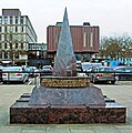
 | Harrow War Memorial | Station Road, outside Harrow Civic Centre 51°35′23″N 0°19′59″W / 51.5898°N 0.3330°W | 2005 | ? | Pillar/column | — | [7] |
| Mural | Kymberley Road, on wall of St George's Shopping Centre 51°34′52″N 0°20′02″W / 51.5810°N 0.3340°W | 2014 | Local people | Mural | — | [8] |
Harrow on the Hill
| Image | Title / subject | Location and coordinates | Date | Artist / designer | Type | Designation | Notes |
|---|---|---|---|---|---|---|---|
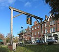
 | Gantry with portrait of Henry VIII | Junction of High Street and Byron Hill Road 51°34′13″N 0°20′23″W / 51.5704°N 0.3397°W | c. 1780 (restored and placed on current site in 2010) | [9] | |||
 | Statue of Elizabeth I | Harrow School, on south tower of Speech Room, overlooking Peterborough Road 51°34′25″N 0°20′12″W / 51.5737°N 0.3367°W | 19th century (originally at Ashridge Park; moved to Harrow School in 1925) | Richard Westmacott | Statue in niche | Grade II* | [10] |
 | Drinking fountain | Junction of High Street and West Street 51°34′20″N 0°20′17″W / 51.5722°N 0.3381°W | 1880 | Drinking fountain | |||
 More images | Harrow on the Hill War Memorial | Grove Hill, at junction with Lowlands Road 51°34′37″N 0°20′07″W / 51.5769°N 0.3354°W | 1921 | W. D. Caröe | Memorial cross | Grade II | [11] |
| Memorial to Britain's first recorded fatal car accident, in 1899 | Junction of Peterborough Road and Grove Hill 51°34′25″N 0°20′11″W / 51.5737°N 0.3364°W | 1969 | [12] | ||||
| Charles I commemorative plaque | Grove Hill 51°34′27″N 0°20′10″W / 51.5742°N 0.3361°W | [13] | |||||
| Two eagles | 70 High Street, on top of porch 51°34′16″N 0°20′21″W / 51.57115°N 0.33906°W | [14] |
Pinner
| Image | Title / subject | Location and coordinates | Date | Artist / designer | Type | Designation | Notes |
|---|---|---|---|---|---|---|---|
 More images | Pinner War Memorial | High Street, near junction with Grange Gardens 51°35′40″N 0°22′47″W / 51.5944°N 0.3798°W | 1921 | Bertram Mackennal | Pillar/column | Grade II | [15] |
Stanmore
| Image | Title / subject | Location and coordinates | Date | Artist / designer | Type | Designation | Notes |
|---|---|---|---|---|---|---|---|
 More images | Stanmore War Memorial | St John's churchyard 51°36′58″N 0°18′55″W / 51.6161°N 0.3152°W | 1920 | ? | Celtic cross | Grade II | Unveiled 22 July 1922.[16] |
Wealdstone
| Image | Title / subject | Location and coordinates | Date | Artist / designer | Type | Designation | Notes |
|---|---|---|---|---|---|---|---|
 More images | Wealdstone War Memorial | Junction of Spencer Road and High Street 51°35′50″N 0°20′09″W / 51.5972°N 0.3359°W | 1923 | Harold F. Walker and J. C. Rackham | Clock tower | Grade II | [17] |
| Mural commemorating the Harrow and Wealdstone rail crash | Outside Harrow & Wealdstone station 51°35′32″N 0°20′03″W / 51.5922°N 0.3343°W | 2004 | Local schoolchildren | Mural | — | [18] |
References
External links
 Media related to Sculptures in the London Borough of Harrow at Wikimedia Commons
🔥 Top keywords: Main PageSpecial:SearchPage 3Wikipedia:Featured picturesHouse of the DragonUEFA Euro 2024Bryson DeChambeauJuneteenthInside Out 2Eid al-AdhaCleopatraDeaths in 2024Merrily We Roll Along (musical)Jonathan GroffJude Bellingham.xxx77th Tony AwardsBridgertonGary PlauchéKylian MbappéDaniel RadcliffeUEFA European Championship2024 ICC Men's T20 World CupUnit 731The Boys (TV series)Rory McIlroyN'Golo KantéUEFA Euro 2020YouTubeRomelu LukakuOpinion polling for the 2024 United Kingdom general electionThe Boys season 4Romania national football teamNicola CoughlanStereophonic (play)Gene WilderErin DarkeAntoine GriezmannProject 2025


