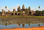
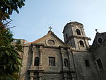
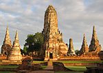
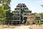
The UNESCO (United Nations Educational, Scientific and Cultural Organization) has designated 45 World Heritage Sites in nine countries (also called "State parties") of Southeast Asia: Cambodia, Indonesia, Laos, Malaysia, Myanmar, Philippines, Singapore, Thailand, and Vietnam. Only Brunei and Timor-Leste (East Timor) lack World Heritage Sites.[1][2]
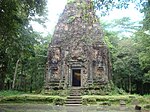
Indonesia lead the list with ten inscribed sites, followed by Vietnam with eight inscribed sites, with Thailand has seven, the Philippines six, Cambodia and Malaysia four each, Laos three, Myanmar two, and Singapore one.[3] The first sites from the region were inscribed at the 15th session of the World Heritage Committee in 1991.[4] The latest site inscribed are Koh Ker: Archaeological Site of Ancient Lingapura or Chok Gargyar in Cambodia, the Ancient Town of Si Thep and its Associated Dvaravati Monuments in Thailand, and the Cosmological Axis of Yogyakarta and its Historic Landmarks in Indonesia, inscribed in the 45th session of the Committee in 2023.[5] Each year, UNESCO's World Heritage Committee may inscribe new sites or delist those no longer meeting the criteria, the selection based on ten criteria of which six stand for cultural heritage (i–vi) and four for natural heritage (vii–x);[6] some sites are "mixed" and represent both types of heritage. In Southeast Asia, there are 30 cultural, 14 natural and 1 mixed sites.[3]
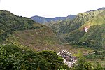
The World Heritage Committee may also specify that a site is endangered, citing "conditions which threaten the very characteristics for which a property was inscribed on the World Heritage List." One site in this region, Tropical Rainforest Heritage of Sumatra, is listed as endangered; Angkor and Rice Terraces of the Philippine Cordilleras were once listed but were taken off in 2004 and 2012 respectively.
By comparison with other world regions such as East Asia, South Asia, Middle East, Central America, and Western Europe, the designation of UNESCO sites in the Southeast Asian region has been regarded as 'too few and too slow' since the inception of the 21st century. Scholars from various Southeast Asian nations have suggested for the establishment of an inclusive Southeast Asian body that will cater to the gaps of the region's activities in UNESCO as the majority of nations in the region are underperforming in the majority of the lists adopted by UNESCO, notably the World Heritage List.
Legend
- Site; named after the World Heritage Committee's official designation[3]
- Location; at city, regional, or provincial level and geocoordinates
- Criteria; as defined by the World Heritage Committee[6]
- Area; in hectares and acres. If available, the size of the buffer zone has been noted as well. A value of zero implies that no data has been published by UNESCO
- Year; during which the site was inscribed to the World Heritage List
- Description; brief information about the site, including reasons for qualifying as an endangered site, if applicable.
World Heritage Sites
Location of sites
Southeast Asia has the fewest UNESCO World Heritage Sites in Asia, next to Central and North Asia, despite being the base of the UNESCO Asia-Pacific headquarters located in Bangkok, Thailand and having a diverse line of natural and cultural heritage sites. Due to this, numerous scholars have been calling on Southeast Asian governments to participate and nominate more sites in UNESCO annually.
Various institutions have also criticized UNESCO for its 'Europe-centric' designations. An example of which was when UNESCO declared 10 UNESCO sites in Italy (a European country) in just a single year (1997). During the same time, 8 sites were declared for the entire Asian continent, where no designated site was located in Southeast Asia at all.[57]
Green - Natural; Yellow - Cultural; Blue - Mixed; Red - In danger
Performance of Southeast Asia in UNESCO
The performance of Southeast Asia is contrasted by the performance of South and East Asia. Southeast Asian countries are in blue.

UNESCO Tentative List of Southeast Asia
Brunei and Timor-Leste currently have no tentative list sites. Both Brunei and Timor-Leste are presently undergoing comprehensive research for tentative site submissions [citation needed]. The latest countries revised their tentative lists are Vietnam and Singapore in 2022, followed by Malaysia and Thailand last revised their tentative lists in 2021, Cambodia last revised in 2020, Laos last revised in 2019, Indonesia and Myanmar last revised in 2018, and the Philippines last revised in 2015. The following lists also include the current nomination process being focused on by each country.
- Cambodia: Currently in process of nominations on 27 March 2020.
- The Site of Angkor Borei and Phnom Da (2020)
- The Archeological complex of Banteay Chhmar (2020)
- Beng Malea Temple (2020)
- Ancient City of Oudong (2020)
- Phnom Kulen: Archeological Site/Ancient Site of Mahendraparvata (2020)
- Former M-13 prison/Tuol Sleng Genocide Museum (former S-21)/Choeung Ek Genocidal Centre (former Execution Site of S-21) (2020)
- The ancient complex of Preah Khan Kompong Svay (2020)
- Indonesia: Currently in process of nomination Kebun Raya Bogor.[58]
- Betung Kerihun National Park (Transborder Rainforest Heritage of Borneo) (2004)
- Bunaken National Park (2005)
- Raja Ampat Islands (2005)
- Taka Bonerate National Park (2005)
- Wakatobi National Park (2005)
- Derawan Islands (2005)
- Tana Toraja Traditional Settlement (2009)
- Bawomataluo Site (2009)
- Muara Takus Compound Site (2009)
- Muarajambi Temple Compound (2009)
- Trowulan - Former Capital City of Majapahit Kingdom (2009)
- Prehistoric Cave Sites in Maros-Pangkep (2009)
- Sangkulirang - Mangkalihat Karts: Prehistoric rock art area (2015)
- The Old Town of Jakarta (Formerly old Batavia) and 4 outlying islands (Onrust, Kelor, Cipir dan Bidadari) (2015) (Nominated in 2018)[59]
- Semarang Old Town (2015)
- Traditional Settlement at Nagari Sijunjung (2015)
- The Historic and Marine Landscape of the Banda Islands (2015)
- Kebun Raya Bogor (2018)
- Laos: Currently in process of nomination That Luang.
- That Luang of Vientiane (1992)
- Hin Nam No National Protected Area (2019)
- Malaysia: Currently in process of nomination Taman Negara.
- National Park (Taman Negara) of Peninsular Malaysia (2014)
- FRIM Selangor Forest Park (2017)
- Gombak Selangor Quartz Ridge (2017)
- Royal Belum State Park (2017)
- Sungai Buloh Leprosarium (2019)
- The Archaeological Heritage of Niah National Park’s Caves Complex, Sarawak, Malaysia (2021)
- Myanmar: Currently in process of nomination Mrauk-U and Shwedagon.[60]
- Wooden Monasteries of Konbaung Period: Ohn Don, Sala, Pakhangyi, Pakhannge, Legaing, Sagu, Shwe-Kyaung (Mandalay) (1996)
- Badah-lin and associated caves (1996)
- Ancient cities of Upper Myanmar: Innwa, Amarapura, Sagaing, Mingun, Mandalay (1996)
- Mrauk-U (1996)
- Inle Lake (1996)
- Mon cities: Bago, Hanthawaddy (1996)
- Ayeyawady River Corridor (2014)
- Hkakabo Razi Landscape (2014)
- Indawgyi Lake Wildlife Sanctuary (2014)
- Natma Taung National Park (2014)
- Myeik Archipelago (2014)
- Hukaung Valley Wildlife Sanctuary (2014)
- Taninthayi Forest Corridor (2014)
- Pondaung anthropoid primates palaeontological sites (2018)
- Shwedagon Pagoda on Singuttara Hill (2018)
- Philippines: Currently in process of nomination Mayon Volcano and Batanes.[61]
- Batanes Protected landscapes and seascapes (1993)
- The Tabon Cave Complex and all of Lipuun (2006)
- Paleolithic Archaeological Sites in Cagayan Valley (2006)
- Kabayan Mummy Burial Caves (2006)
- Butuan Archeological Sites (2006)
- Baroque Churches of the Philippines (Extension) (2006)
- Petroglyphs and Petrographs of the Philippines (2006)
- Neolithic Shell Midden Sites in Lal-lo and Gattaran Municipalities (2006)
- Chocolate Hills Natural Monument (2006)
- Mt. Malindang Range Natural Park (2006)
- Mt. Pulag National Park (2006)
- Apo Reef Natural Park (2006)
- El Nido-Taytay Managed Resource Protected Area (2006)
- Coron Island Natural Biotic Area (2006)
- Mt. Iglit-Baco National Park (2006)
- Northern Sierra Madre Natural Park and outlying areas inclusive of the buffer zone (2006)
- Mt. Mantalingahan Protected Landscape (2015)
- Mayon Volcano Natural Park (MMVNP) (2015)
- Turtle Islands Wildlife Sanctuary (2015)
- Singapore: Currently in process of nomination Padang.
- The Padang Civic Ensemble (2022)
- Thailand: Currently in process of nomination Phuphrabat.[62]
- Phuphrabat Historical Park (2004)
- Wat Phra Mahathat Woramahawihan, Nakhon Si Thammarat (2012)
- Monuments, Sites and Cultural Landscape of Chiang Mai, Capital of Lanna (2015)
- Phra That Phanom, its related historic buildings and associated landscape (2017)
- Ensemble of Phanom Rung, Muang Tam and Plai Bat Sanctuaries (2019)
- The Andaman Sea Nature Reserves of Thailand (2021)
- Songkhla and its Associated Lagoon Settlements (2024)
- Vietnam: Currently in process of nomination Sapa.
- Huong Son Complex of Natural Beauty and Historical Monuments (1991)
- The Area of Old Carved Stone in Sapa (1997)
- Cat Tien National Park (2006)
- Con Moong Cave (2006)
- Ba Be - Na Hang Natural Heritage Area (2017)
- The Yen Tu Complex of Monuments and Landscapes (2021)
- Oc Eo - Ba The archaeological site (2022)
See also
- Intangible Cultural Heritage Register of Southeast Asia
- Southeast Asia Memories of the World Register
- UNESCO Biosphere Reserves of Southeast Asia
- List of World Heritage Sites in Indonesia
- List of World Heritage Sites in Thailand
- List of World Heritage Sites in the Philippines
- List of World Heritage Sites in Malaysia
- List of World Heritage Sites in Cambodia
- List of World Heritage Sites in Vietnam
Notes
References
General sources
- "World Heritage Committee: Sixteenth session" (PDF). UNESCO. Retrieved 28 May 2010.
- "World Heritage Committee: Twenty-eighth session" (PDF). UNESCO. Retrieved 26 June 2011.
- "List of World Heritage Sites in Southeast Asia with large pictures". Retrieved 6 March 2015.

