The U.S. state of Nevada maintains a system of scenic byways throughout the state. Currently, there are 20 designated state scenic byways. Some of these state scenic byways have also been incorporated into national byway designations.
| Nevada Scenic Byways | |
|---|---|
| System information | |
| Length | 420 mi[1] (680 km) |
| Formed | 1983[1] |
| Highway names | |
| Interstates | Interstate nn (I-nn) |
| US Highways | US Route nn (US nn) |
| State | State Route nn (SR nn) |
| System links | |
| |
State scenic byways

Nevada's scenic byway program was established by the Nevada Legislature in 1983. The Nevada Department of Transportation is the primary agency responsible for the program, and its director has the authority to add new byways into the system.[1]
As of 2015, 20 road segments throughout Nevada have been designated as state scenic byways. The system comprises approximately 420 miles (680 km) of roads.[1] Fifteen of the state's scenic byways overlap with state-maintained highways.
| Name | Length (mi)[1] | Length (km) | Southern or western terminus | Northern or eastern terminus | Date[2] | Description |
|---|---|---|---|---|---|---|
| Angel Lake Road | 11.7 | 18.8 | Angel Lake | SR 232 in Wells | 1995 | Follows SR 231 as it traverses through the East Humboldt Range in Elko County towards Angel Lake. |
| Baker Road | 11.6 | 18.7 | Nevada–Utah state line | US 6/US 50 | 2000 | Follows SR 487 in White Pine County via the town of Baker, providing access to Great Basin National Park. |
| Deer Creek Road | 8.8 | 14.2 | SR 157 in Mount Charleston | SR 156 near Lee Canyon | 1998 | Follows SR 158 as it traverses through the Spring Mountains between Kyle Canyon and Lee Canyon in Clark County. |
| Gerlach Road | 4.5 | 7.2 | Marble Dam Road | North of Nixon | 1996 | Follows SR 477 in Washoe County near Nixon on the east side of Pyramid Lake within the Pyramid Lake Indian Reservation. |
| Kyle Canyon Road | 13.0 | 20.9 | Mount Charleston | Northwest of Las Vegas | 1998 | Follows SR 157 in Clark County northwest of Las Vegas through Kyle Canyon in the Spring Mountains towards Mount Charleston. |
| Lamoille Canyon Road | 12.5 | 20.1 | Ruby Mountains | SR 227 near Lamoille | ? | Follows National Forest Road 660 in Elko County, through Lamoille Canyon in the Ruby Mountains. |
| Lehman Caves Road | 5.4 | 8.7 | Great Basin National Park | SR 487 in Baker | 2000 | Follows SR 488 in White Pine County from Baker to the main gate of Great Basin National Park. |
| Mt. Charleston/Lee Canyon Road | 17.5 | 28.2 | Lee Canyon in Mount Charleston | US 95 northwest of Las Vegas | 1998 | Follows SR 156 as it traverses through the Spring Mountains towards Lee Canyon in Clark County. |
| Mt. Rose Highway | 22.2 | 35.7 | SR 28 in Incline Village | southwest of Reno | 1996 | Follows SR 431 in Washoe County. Passes by the Mount Rose Wilderness via the highest year-round pass in the Sierra Nevada at 8,911 feet (2,716 m)[3] |
| North Las Vegas Strip | 2.9 | 4.7 | Sahara Avenue (SR 589) in Las Vegas | Washington Avenue (SR 578) in Las Vegas | 2001 | Follows Las Vegas Boulevard through Downtown Las Vegas in Clark County. |
| North Shore Road | 16.1 | 25.9 | US 50 near Spooner Lake | Nevada–California state line at Crystal Bay | 1994 | Follows SR 28 in western Nevada along the northern and eastern shores of Lake Tahoe. |
| Pyramid Lake Road | 12.5 | 20.1 | Pyramid Lake Indian Reservation boundary south of Sutcliffe | Warrior Point | 1996 | Follows SR 445 in Washoe County along the western shore of Pyramid Lake within the Pyramid Lake Indian Reservation. |
| Red Rock Road | 8.8 | 14.2 | South boundary of Red Rock Canyon NCA near Blue Diamond | East boundary of Red Rock Canyon NCA in Las Vegas | 1995 | Follows SR 159 through the Red Rock Canyon National Conservation Area west of Las Vegas in Clark County. |
| South Las Vegas Strip | 4.5 | 7.2 | Russell Road (SR 594) in Paradise | Sahara Avenue (SR 589) in Las Vegas | 1995 | America's first nighttime scenic byway; Follows Las Vegas Boulevard along the Las Vegas Strip in Clark County. |
| Sutcliffe/Nixon Road | 13.2 | 21.2 | SR 445 southeast of Sutcliffe | SR 447 in Nixon | 1996 | Follows SR 446 in Washoe County along the southern shore of Pyramid Lake within the Pyramid Lake Indian Reservation. |
| US 6/US 50/US 93 | 63.0 | 101.4 | south of Ely | Nevada–Utah state line | 2000 | Follows US 6/US 50/US 93 in White Pine County near the northern reaches of Great Basin National Park. |
| US 50 | 21.5 | 34.6 | Nevada–California state line at Stateline | West of Carson City | 1994 | Follows US 50 in western Nevada along the eastern shores of Lake Tahoe and down through the Carson Range towards Carson City. |
| US 93 (Great Basin Highway) | 148.8 | 239.5 | SR 318 near Crystal Springs | US 6/US 50 at Majors Place | ? | Nevada's first scenic byway; Follows US 93 in Lincoln and White Pine counties via Caliente and Pioche. Connects five state parks and Great Basin National Park. |
| Valley of Fire Road | 10.5 | 16.9 | West entrance to Valley of Fire State Park | East entrance to Valley of Fire State Park | 1995 | Follows Valley of Fire Road through Valley of Fire State Park in Clark County. |
| White Domes Road | 6.9 | 11.1 | Valley of Fire Road | End of pavement near White Domes | 1995 | Follows White Domes Road in Valley of Fire State Park, Clark County. |
Nationally designated scenic byways
The National Scenic Byways program has four listings in Nevada, including one All-American Road.[4] Additionally, one byway is part of the National Forest Scenic Byway program. All national byway designations comprise one or more of the Nevada scenic byways above.
| Type | Name | Length (mi) | Length (km) | Southern or western terminus | Northern or eastern terminus | Date | State scenic byways incorporated in designation | Ref(s). |
|---|---|---|---|---|---|---|---|---|
| National Scenic Byway | City of Las Vegas, Las Vegas Boulevard National Scenic Byway | 3.4 | 5.5 | Sahara Avenue in Las Vegas | Washington Avenue in Las Vegas | 2009 | North Las Vegas Strip | [5][6] |
| National Scenic Byway | Lake Tahoe - Eastshore Drive | 28.0 | 45.1 | Stateline | Incline Village | ? | Part of US 50; North Shore Road | [7] |
| National Forest Scenic Byway | Lamoille Canyon Scenic Byway | 12.5 | 20.1 | Ruby Mountains | SR 227 near Lamoille | ? | Lamoille Canyon Road | [2][8] |
| All-American Road | Las Vegas Strip | 4.5 | 7.2 | Welcome to Fabulous Las Vegas sign | Sahara Avenue in Las Vegas | 2000 | South Las Vegas Strip | [2][9] |
| National Scenic Byway | Pyramid Lake Scenic Byway | 30.2 | 48.6 | Multiple termini near Pyramid Lake | 1996 | Gerlach Road, Pyramid Lake Road and Sutcliffe/Nixon Road | [2][10] | |
Gallery
 Angel Lake Road near Angel Lake
 Kyle Canyon seen from Kyle Canyon Road
 Lehman Caves Road entering Great Basin National Park
 View of Lake Tahoe from North Shore Road
 Red Rock Road entering Red Rock Canyon
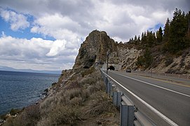 Cave Rock Tunnels on US 50 near Lake Tahoe
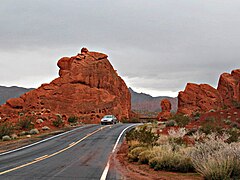 Valley of Fire Road
 Lamoille Canyon Road
 The Las Vegas Strip, an "All-American Road"
_about_1.0_mile_%22north%22_of_Angel_Lake.JPG)

_at_Great_Basin_National_Park,_Nevada.JPG)


See also

References
External links
 Media related to Nevada Scenic Byways at Wikimedia Commons
- Nevada Commission on Tourism