Kotor Varoš (Serbian Cyrillic: Котор Варош) is a town and municipality in Republika Srpska, Bosnia and Herzegovina. As of 2013 census, the municipality has a population of 19,710 inhabitants, while the town of Kotor Varoš has a population of 7,330 inhabitants.
Kotor Varoš Котор Варош | |
|---|---|
Town and municipality | |
 Kotor Varoš | |
.svg) Coat of arms | |
 Location of Kotor Varoš within Republika Srpska | |
 | |
| Coordinates: 44°37′20″N 17°22′13″E / 44.62222°N 17.37028°E | |
| Country | |
| Entity | |
| Government | |
| • Municipal mayor | Zdenko Sakan (PDP) |
| • Municipality | 544.26 km2 (210.14 sq mi) |
| Population (2013 census) | |
| • Town | 7,330 |
| • Municipality | 19,710 |
| • Municipality density | 36/km2 (94/sq mi) |
| Time zone | UTC+1 (CET) |
| • Summer (DST) | UTC+2 (CEST) |
| Area code | 51 |

History
An early Roman (3rd–5th c.) basilica was discovered along with other Roman findings in the Šiprage area, at the Crkvenica-Vrbanja river mouth. 12th-century stećci testify a medieval settlement.[2][3] The original location of the stećci was at the Crkvenica-Vrbanja, from where they were removed and built into the walls of surrounding buildings (possibly due to the belief in their miraculous properties).[2] One of the best preserved steći is submerged in the Vrbanja.
It has been theorized that Kotor Varoš was mentioned in the De Administrando Imperio as "Katera" (Greek: Κατερα),[4][5] a part of the "land of Bosnia".[6]
The town was part of the Donji Kraji province of the Banate of Bosnia in the 13th century, and the Kingdom in the 14th and 15th century. The Kotor fortress and its podgrađe was the property of the Hrvatinić noble family.
Austro-Hungarian rule in Bosnia and Herzegovina began in 1878 and ended with the establishment of the Kingdom of Serbs, Croats and Slovenes in 1918, later renamed Kingdom of Yugoslavia. The town was part of the Vrbas Banovina (1929–41), but after World War II it became part of the Socialist Republic of Bosnia and Herzegovina, a republic of Yugoslavia.
Settlements
Aside from the town of Kotor Varoš, the municipality includes the following settlements:
- Baština
- Bilice
- Boljanići
- Borci Donji
- Borci Gornji
- Ćorkovići
- Duratovci
- Garići
- Grabovica
- Hadrovci
- Hrvaćani
- Hanifići
- Jakotina
- Kruševo Brdo
- Liplje
- Maljeva
- Maslovare
- Obodnik
- Orahova
- Palivuk
- Plitska
- Podbrđe
- Podosoje
- Postoje
- Prisočka
- Radohova
- Ravne
- Selačka
- Sokoline
- Stopan
- Šibovi
- Šiprage
- Tovladić
- Vagani
- Varjače
- Večići
- Viševice
- Vranić
- Vrbanjci
- Zabrđe
- Zaselje
Demographics
Population
| Population of settlements – Kotor Varoš municipality | ||||||||||||
|---|---|---|---|---|---|---|---|---|---|---|---|---|
| Settlement | 1895. | 1910. | 1921. | 1931. | 1948. | 1953. | 1961. | 1971. | 1981. | 1991. | 2013. | |
| Total | 20,858 | 23,780 | 22,072 | 27,236 | 22,198 | 37,898 | 32,516 | 32,832 | 35,713 | 36,653 | 19,710 | |
| 1 | Borci Donji | 419 | 255 | |||||||||
| 2 | Garići | 1,341 | 498 | |||||||||
| 3 | Grabovica | 887 | 345 | |||||||||
| 4 | Hrvaćani | 745 | 248 | |||||||||
| 5 | Kotor Varoš | 312 | 1,361 | 1,428 | 1,400 | 2,428 | 4,715 | 2,893 | 3,746 | 5,423 | 7,411 | 7,330 |
| 6 | Liplje | 744 | 271 | |||||||||
| 7 | Maljeva | 595 | 200 | |||||||||
| 8 | Maslovare | 2,284 | 1,930 | |||||||||
| 9 | Orahova | 842 | 650 | |||||||||
| 10 | Prisočka | 1,423 | 208 | |||||||||
| 11 | Radohova | 700 | 236 | |||||||||
| 12 | Šibovi | 671 | 230 | |||||||||
| 13 | Šiprage | 952 | 652 | |||||||||
| 14 | Večići | 1,744 | 608 | |||||||||
| 15 | Vrbanjci | 2,975 | 1,902 | |||||||||
| 16 | Zabrđe | 1,154 | 482 | |||||||||
Ethnic composition
| Ethnic composition – Kotor Varoš town | |||||||
|---|---|---|---|---|---|---|---|
| 2013. | 1991. | 1981. | 1971. | ||||
| Total | 7,330 | 7,411 | 5,423 | 3,746 | |||
| Serbs | 6,251 (82.2%) | 2,522 (34%) | 1,310 (24.2%) | 749 (20%) | |||
| Bosniaks | 920 (12.1%) | 1,800 (24.3%) | 1,436 (26.5%) | 1,342 (35.8%) | |||
| Croats | 252 (3.3%) | 2,432 (32.8%) | 1,789 (33%) | 1,490 (40%) | |||
| Others | 180 (2.4%) | 110 (1.5%) | 101 (1.8%) | 47 (1.2%) | |||
| Yugoslavs | 547 (7.4%) | 787 (14.5%) | 110 (3%) | ||||
| Ethnic composition – Kotor Varoš municipality[7][8] | |||||||
|---|---|---|---|---|---|---|---|
| 2013. | 1991. | 1981. | 1971. | ||||
| Total | 19,710 | 36,853 | 35,713 | 32,832 | |||
| Serbs | 13,091 (66.4%) | 14,056 (38.1%) | 14,771 (41.4%) | 15,255 (46.5%) | |||
| Bosniaks | 5,241 (26.6%) | 11,090 (30%) | 9,667 (27.1%) | 8,366 (25.5%) | |||
| Croats | 1,116 (5.6%) | 10,695 (29%) | 9,572 (26.8%) | 8,863 (27%) | |||
| Others | 262 (1.3%) | 267 (0.7%) | 405 (1.1%) | 172 (0.5%) | |||
| Yugoslavs | 745 (2%) | 1,298 (3.6%) | 176 (0.5%) | ||||
Economy
The following table gives a preview of total number of registered employed people per their core activity (as of 2016):[9]
| Professional field | Total |
|---|---|
| Agriculture, forestry and fishing | 300 |
| Mining and quarrying | 2 |
| Manufacturing | 2,998 |
| Distribution of power, gas, steam and air-conditioning | 45 |
| Distribution of water and water waste management | 43 |
| Construction | 84 |
| Wholesale and retail, repair | 342 |
| Transportation and storage | 126 |
| Hotels and restaurants | 112 |
| Information and communication | 24 |
| Finance and insurance | 25 |
| Real estate activities | 5 |
| Professional, scientific and technical activities | 27 |
| Administrative and support services | 91 |
| Public administration and defence | 193 |
| Education | 316 |
| Healthcare and social work | 115 |
| Art, entertainment and recreation | 7 |
| Other service activities | 55 |
| Total | 4,910 |
Famous people
- Croatian footballer Mateo Kovačić's parents are from Kotor Varoš
Features
The city also features a large monument to the local partisans who died for Yugoslavia during the fighting with the German and Ustaša forces during WW2.
Sister cities
 Kranj, Slovenia
 Herceg Novi, Montenegro
 Kraljevo, Serbia


Gallery
 Swimming dam on the Bobas, a popular attraction
 Red Cross building in Kotor Varoš
 "Kocke" apartment blocks in town
 Elementary school "Sveti Sava" (formerly "Bratstvo i jedinstvo")
 Orthodox church in Kotor Varoš
 Catholic church in Kotor Varoš, rebuilt
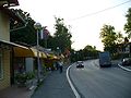 Old marketplace, čaršija, shops on the left side


References
Sources
- Vojnogeografski institut, Izd. (1955): Prnjavor (List karte 1:100.000, Izohipse na 20 m). Vojnogeografski institut, Beograd.
- Spahić M. et al. (2000): Bosna i Hercegovina (1:250.000). Izdavačko preduzeće "Sejtarija", Sarajevo.
- Mučibabić B., Ur. (1998): Geografski atlas Bosne i Hercegovine. Geodetski zavod BiH, Sarajevo.