Gauriganj is a city, municipal corporation, tehsil and administrative headquarters of Amethi district in Ayodhya division, Uttar Pradesh, India.[4] It is situated about 126 km from the state capital Lucknow. Before July 2010, it was part of Sultanpur district. After that Gauriganj, Amethi, Jais, Jagdispur and Salon formed a new district Chhatrapati Sahuji Maharaj Nagar, later named Gauriganj and now Amethi. Gauriganj is connected with State Highway 34 and National Highway 128.
Gauriganj | |
|---|---|
Town | |
 Gauriganj skyline | |
 Map of Gauriganj CD block | |
 Gauriganj Location of Gauriganj in Uttar Pradesh  Gauriganj Gauriganj (India) | |
| Coordinates: 26°12′22″N 81°41′24″E / 26.206°N 81.690°E | |
| Country | |
| State | Uttar Pradesh |
| Division | Ayodhya |
| District | Amethi |
| Government | |
| • Type | Municipal Council |
| • Body | Gauriganj Municipal Council |
| • Municipal Chairperson | Reshmi[1][2] (BJP) |
| • MLA | Rakesh Pratap Singh (SP)[3] |
| Elevation | 104 m (341 ft) |
| Population (2011)[4] | |
| • Total | 390,935 |
| • Density | 855/km2 (2,210/sq mi) |
| Language | |
| • Official | Hindi[5] |
| • Additional official | Urdu[5] |
| Time zone | UTC+5:30 (Indian Standard Time) |
| Postal code | 227409 |
| Telephone code | 05-368 |
| Sex ratio | 904:1000 ♂/♀ |
| Vehicle Registration | UP-36 |
Etymology
Gauriganj is named after Gauri, a deity in Hinduism.[citation needed]
History
At the turn of the 20th century, Gauriganj was described as "a rising town, with a station on the Oudh and Rohilkhand Railway."[6] It then technically consisted of two villages, Katra-Lalganj and Madhopur.[6] The bazar was founded by Madho Singh, the Raja of Amethi (d.1891).[6] Gauriganj then hosted a rising grain market and had a pound, police station, and post office, as well as an upper primary school, which had many students from both Gauriganj itself and the surrounding countryside; it had a small building, though, which was not big enough to accommodate the student body adequately.[6] The town was then surrounded by several deep hollows.[6] West of Katra-Lalganj were low-lying fields where only jarhan rice was grown.[6] The population of Gauriganj as of 1901 was 2,543, including a large Bania community which was larger than any other town in the district except Sultanpur.[6] There was a Muslim minority of 194, and the rest of the town's population was a mix of Ahirs, Kurmis, and Gadariyas, as well as some Pasis.[6]
Geography
Climate
Gauriganj has a warm subtropical climate with very cold and dry winters from December to mid-February, and dry, hot summers from April to mid-June. During extreme winters, the maximum temperature is around 12 degrees Celsius and the minimum is around 3 to 4 degrees Celsius. Fog is quite common from late December to late January. Summers can be quite hot with temperatures rising to 40 to 45 degrees Celsius.
Gauriganj has a tropical wet and dry climate with average temperatures ranging between 20 and 28 °C (68 and 82 °F). Gauriganj experiences three distinct seasons: summer, monsoon and a mild autumn. Typical summer months are from March to May, with maximum temperatures ranging from 30 to 45 °C (86 to 113 °F). Although summer doesn't end until May, the city often receives heavy thundershowers in May, and humidity remains high. The rainy season is from mid-June to mid-September, when it gets an average rainfall of 722 mm, mostly from the south-west monsoon winds. Even during the hottest months, the nights are usually cool due to Gauriganj's altitude. The highest temperature ever recorded was 48.3 °C (118.9 °F). The monsoon lasts from June to October, with moderate rainfall and temperatures ranging from 10 to 28 °C (50 to 82 °F). Autumn begins in November. The daytime temperature hovers around 28 °C (82 °F) while the night temperature is below 10 °C (50 °F) for most of December and January, often dropping to 3 to 4 °C (37 to 39 °F).
Demographics
As of 2011 Indian Census, Gauriganj tehsil had a total population of 390,935, of which 196,844 were males and 194,091 were females. Population within the age group of 0 to 6 years was 59,192. The total number of literates in Gauriganj was 214,282, which constituted 54.8% of the population with male literacy of 60.1% and female literacy of 45.4%. The effective literacy rate of 7+ population of Gauriganj was 64.6%, of which male literacy rate was 75.9% and female literacy rate was 53.3%. The Scheduled Castes and Scheduled Tribes population was 108,841 and 86 respectively. Gauriganj had 67,832 households in 2011.[4]
The 1961 census recorded Gauriganj as having a population of 1,883 people (1,038 male and 845 female), in 468 households and 456 physical houses.[7]
Languages and religion

Hindi and Urdu are the official languages. Awadhi is also widely spoken along with English.
Hinduism is followed by large numbers of the population. A significant part of the population of the city consists of followers of Islam and Sikhism. Christians and Jains constitute a minority of the population.
Government and politics
Civic administration
Gauriganj had a police force of 2 sub-inspectors, 1 head constable, and 13 constables.[7]
Amenities
Gauriganj has a post office, a railway station, a library, and a government-run dispensary with 4 male and 2 female beds, as well as a maternity and child welfare centre and a family planning centre.[7]
Economy
Gauriganj hosts a grain market on Mondays and Fridays, with an average attendance of about 2,000 at the time of the 1961 census.[7]
Cityscape / Culture
Durga Puja is celebrated in Gauriganj with cultural activities from the 8th day of Navratri for 14 days. Moorty Visarjan is also a big event as it takes approximately 90 hours to complete with thousands of indulged people. Krishna Janmashtami is also celebrated with great joy. In Some Aashram (likes: Baba Balak Das etc.) and some temples (e.g. Doodh Nath Mandir, Ram Janki Mandir, Hanuman Mandir) Feast (i.e. Vishal Bhog Bhandara) took places annually.[clarification needed]
Eid-ul-Fitr, Eid-ul-Adha, Eid Milad-un-Nabi and Shab-e-Barat are also celebrated in Gauriganj.
Places of interest
Education
The 1951 census recorded Gauriganj as having a district board-run primary school, with 201 students in attendance as of 1 January of the year.[8]
Villages
Gauriganj CD block has the following 102 villages:[9]
| Village name | Total land area (hectares) | Population (in 2011) |
|---|---|---|
| Manmatipur | 194 | 795 |
| Bhatgawan | 389.7 | 3,654 |
| Bastidai | 464.1 | 2,086 |
| Manjhwara | 428.9 | 3,074 |
| Gulalpur | 273.4 | 1,208 |
| Benipur Baldeo | 256.7 | 1,398 |
| Rauja | 190.1 | 1,538 |
| Tulsi Pur | 246.1 | 1,341 |
| Mau | 504.1 | 3,865 |
| Sarauli | 127 | 687 |
| Oripur | 191 | 1,883 |
| Basupur | 194 | 1,402 |
| Itaujapachhim | 290.2 | 2,303 |
| Mohanpur | 45.4 | 107 |
| Gopalipur | 178.4 | 603 |
| Sujanpur | 379.8 | 1,872 |
| Narauli | 345.7 | 2,153 |
| Guwawan | 665.2 | 4,716 |
| Rohshi Khurd | 432.8 | 2,078 |
| Sarai Hirday Shah | 361.6 | 2,564 |
| Jagdishpur | 187.7 | 1,384 |
| Bishundas Pur | 393.2 | 2,255 |
| Gauri Pur | 266.3 | 2,690 |
| Gopiya Pur | 29 | 294 |
| Hasram Pur | 44.4 | 118 |
| Ana Pur | 156.3 | 1,072 |
| Dost Pur | 101 | 586 |
| Jethauna | 176.8 | 1,018 |
| Harakh Pur | 236.1 | 1,892 |
| Jethumawai | 95 | 1,037 |
| Medan Mawi | 88.9 | 418 |
| Belkhaur | 83.7 | 1,950 |
| Lila Tikara | 78.6 | 417 |
| Suja Pur | 38.2 | 333 |
| Dhani Jalalpur | 55.6 | 685 |
| Basthan | 51.1 | 233 |
| Shahbaj Pur | 152.2 | 1,222 |
| Garha Mafi | 220.6 | 1,563 |
| Darpipur | 158.8 | 1,012 |
| Baburi Tola | 48.6 | 402 |
| Sarai Barwand Singh | 125.5 | 984 |
| Behta | 231.1 | 1,557 |
| Barna Tikar | 447.5 | 2,927 |
| Madho Pur | 179.2 | 4,717 |
| Raj Garh | 107.3 | 2,028 |
| Misrauli | 231.8 | 1,738 |
| Sarai Bhag Mani | 235.8 | 2,185 |
| Mahima Pur | 218.5 | 737 |
| Asaida Pur | 158.9 | 1,387 |
| Katra Lal Ganj | 230.1 | 5,834 |
| Bali Pur Khurdwan | 112.6 | 1,449 |
| Amiya | 123.6 | 799 |
| Chauhan Pur | 61.8 | 360 |
| Palia | 68.1 | 549 |
| Argwan | 174.3 | 1,195 |
| Sembhue | 135.8 | 966 |
| Kaji Patti | 44.3 | 503 |
| Rampur Kurwa | 183.5 | 1,298 |
| Senipur | 73.7 | 653 |
| Madhupur | 51 | 214 |
| Sultanpur | 63.4 | 493 |
| Jagmalpur | 113.9 | 520 |
| Paiga | 293.1 | 1,053 |
| Gvjar Tol | 141.4 | 1,102 |
| Pure Fajil | 312.2 | 1,685 |
| Dharu Pur | 117 | 1,112 |
| Sogara | 376.2 | 1,693 |
| Biswan | 59.2 | 353 |
| Asura | 123.1 | 803 |
| Dhanapur | 110 | 953 |
| Bhawan Shah Pur | 129 | 821 |
| Lugri | 314 | 1,148 |
| Pachehri | 234.1 | 1,403 |
| Paharpur | 84.3 | 494 |
| Raghipur | 60 | 1,207 |
| Banwari Pur | 94.1 | 337 |
| Ronhsi Buzurg | 210.3 | 1,072 |
| Chandai Pur | 199.7 | 1,329 |
| Atta Nagar | 244.4 | 1,417 |
| Bahan Pur | 194 | 1,828 |
| Sakrawan | 225.4 | 1,322 |
| Ramai Pur | 126.2 | 381 |
| Saripur | 162.2 | 895 |
| Kharanwan | 112.2 | 1,056 |
| Saintha | 639.6 | 4,076 |
| Tikariya | 360.8 | 2,031 |
| Khajuri | 147 | 1,066 |
| Basaikpur | 193.4 | 1,787 |
| Gundur | 168.9 | 1,020 |
| Raja Patti | 63.1 | 278 |
| Babupur | 122.4 | 1,226 |
| Anni Baijal | 460 | 3,063 |
| Aintha | 116.9 | 1,369 |
| Pathanpur | 221.4 | 1,449 |
| Pahar Ganj | 404.9 | 2,682 |
| Ismailpur | 52 | 427 |
| Chhitepur | 153.1 | 1,093 |
| Pandri | 412 | 2,513 |
| Gudun Pur | 106 | 874 |
| Samhanwa | 495 | 2,561 |
| Pure Udhao | 17.1 | 267 |
| Lal Shah Pur | 125.1 | 422 |
| Block total | 144,669 | 20,372.8 |
| Village name | Total land area (hectares) | Population (in 2011) |
Notable people
- Manoj Muntashir is an Indian lyricist, poet and screenwriter was born in this town.
- Rakesh Pandey (writer and author)
- Jagdish Piyush (journalist, writer and author)
- Akshay Pratap Singh (MLC and former MP)
- Deepak Singh (former MLC)
- Rakesh Pratap Singh (MLA)
- Rudra Pratap Singh (former MP, former MLA, former MLC)
Gallery
 Bhandara at Baba Balak Das Ashram, Stage (2011)
 Bhandara at Baba Balak Das Ashram (2011)
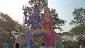 Hanuman Mandir, Madhopur


.jpg)