
Size of this PNG preview of this SVG file: 687 × 382 pixels. Other resolutions: 320 × 178 pixels | 640 × 356 pixels | 1,024 × 569 pixels | 1,280 × 712 pixels | 2,560 × 1,423 pixels.
Original file (SVG file, nominally 687 × 382 pixels, file size: 252 KB)
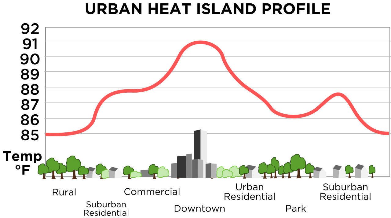
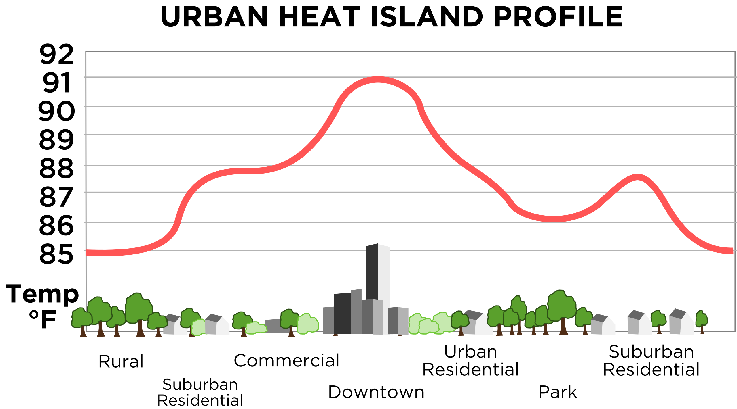
| Description | English: Vastly improved version of this, retraced in SVG. Original images source is this image from NOAA. | |||
| Date | 11/23/08 | |||
| Source | Own work | |||
| Author | TheNewPhobia | |||
| Permission (Reusing this file) |
| |||
| Other versions | Derivative works of this file: Urban heat island (Celsius).png |
.png)
File history
Click on a date/time to view the file as it appeared at that time.
| Date/Time | Thumbnail | Dimensions | User | Comment | |
|---|---|---|---|---|---|
| current | 16:55, 23 November 2008 | | 687 × 382 (252 KB) | TheNewPhobia | {{Information |Description={{en|1=Vastly improved version of this, retraced in SVG. Original images source is [http://www.crh.noaa.gov/images/lsx/recent_event/urban.gif this image] from NOAA.}} |Source=Own work by |
File usage
The following pages on the English Wikipedia use this file (pages on other projects are not listed):
Global file usage
The following other wikis use this file:
- Usage on fi.wikipedia.org
- Usage on gl.wikipedia.org
- Usage on it.wikipedia.org
- Usage on www.wikidata.org
- Usage on zh.wikipedia.org
🔥 Top keywords: Main PageSpecial:SearchPage 3Wikipedia:Featured picturesHouse of the DragonUEFA Euro 2024Bryson DeChambeauJuneteenthInside Out 2Eid al-AdhaCleopatraDeaths in 2024Merrily We Roll Along (musical)Jonathan GroffJude Bellingham.xxx77th Tony AwardsBridgertonGary PlauchéKylian MbappéDaniel RadcliffeUEFA European Championship2024 ICC Men's T20 World CupUnit 731The Boys (TV series)Rory McIlroyN'Golo KantéUEFA Euro 2020YouTubeRomelu LukakuOpinion polling for the 2024 United Kingdom general electionThe Boys season 4Romania national football teamNicola CoughlanStereophonic (play)Gene WilderErin DarkeAntoine GriezmannProject 2025