
Original file (996 × 962 pixels, file size: 112 KB, MIME type: image/png)
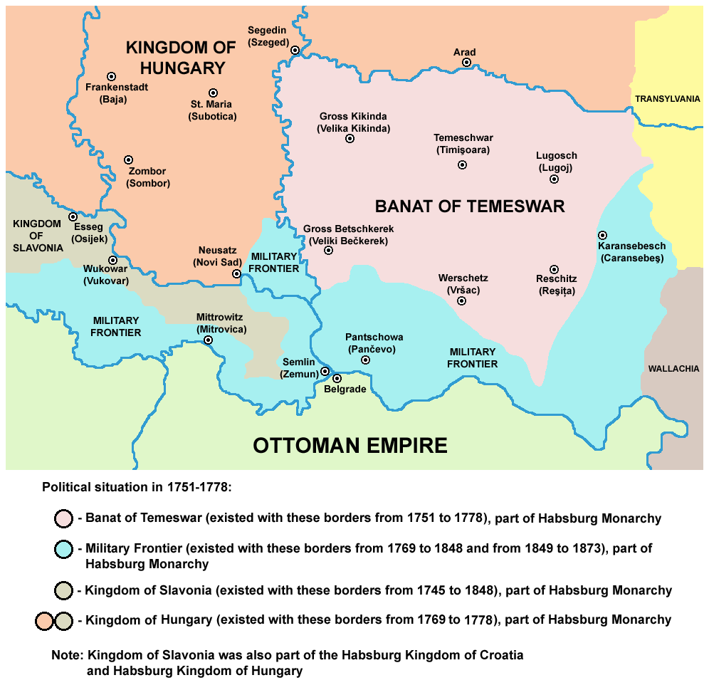
| DescriptionTamis banat1751 1778.png | English: map of the Banat of Temeswar, Kingdom of Slavonia and Military Frontier in 1751-1778. Српски / srpski: мапа Тамишког Баната, Краљевине Славоније и војне границе (1751-1778. године) |
| Date | 1 August 2009 (original upload date) |
| Source | No machine-readable source provided. Own work assumed (based on copyright claims). |
| Author | No machine-readable author provided. PANONIAN assumed (based on copyright claims). |
self made map by user:PANONIAN
| Public domainPublic domainfalsefalse |
| I, the copyright holder of this work, release this work into the public domain. This applies worldwide. In some countries this may not be legally possible; if so: I grant anyone the right to use this work for any purpose, without any conditions, unless such conditions are required by law. |
Click on a date/time to view the file as it appeared at that time.
| Date/Time | Thumbnail | Dimensions | User | Comment | |
|---|---|---|---|---|---|
| current | 11:55, 24 June 2014 | | 996 × 962 (112 KB) | PANONIAN | aesthetics |
| 13:18, 14 February 2013 |  | 996 × 962 (114 KB) | PANONIAN | {{Information |Description ={{en|1=easthetics}} |Source =easthetics |Author =easthetics |Date = |Permission = |other_versions = }} | |
| 19:51, 30 September 2011 |  | 998 × 962 (114 KB) | PANONIAN | correction | |
| 14:49, 30 September 2011 |  | 998 × 962 (115 KB) | PANONIAN | some corrections | |
| 11:27, 1 August 2009 |  | 998 × 962 (115 KB) | PANONIAN | ==Description== * '''English''': map of the Banat of Temeswar, Kingdom of Slavonia and Military Frontier in 1751-1778. * '''Serbian''': мапа Тамишког Баната, Краљевине Славоније и војне границе (1751-1778. |
The following other wikis use this file: