

Original file (SVG file, nominally 1,850 × 1,229 pixels, file size: 466 KB)
| DescriptionSiege of Kobane.svg | |
| Date | |
| Source | Map originally made by Mouradi. |
| Author | Mouradi |
| SVG development InfoField |
Click on a date/time to view the file as it appeared at that time.
| Date/Time | Thumbnail | Dimensions | User | Comment | |
|---|---|---|---|---|---|
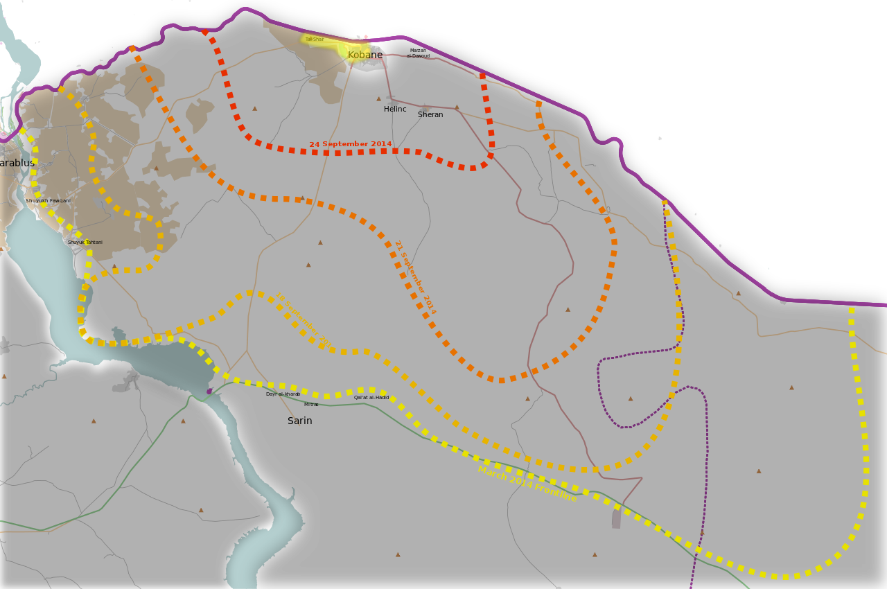
| current | 12:49, 30 October 2014 | | 1,850 × 1,229 (466 KB) | Mouradi | YPG controls Tall Shaer. http://www.dailymail.co.uk/news/article-2793880/the-great-kobane-fightback-symbolic-recapture-hill-black-flag-isis-kurdish-fighters-swathes-city-step-airstrikes.html |
| 15:15, 11 October 2014 |  | 1,850 × 1,229 (465 KB) | MrPenguin20 | Update according to http://www.thetimes.co.uk/tto/multimedia/archive/00781/inline_b7a952ca-4da_781457a.jpg | |
| 00:22, 5 October 2014 |  | 1,850 × 1,229 (465 KB) | MrPenguin20 | Added changes showing current level of control (as of 5th October 2014). Evolution of siege done from information from BBC (http://news.bbcimg.co.uk/media/images/77873000/jpg/_77873560_kobane_map624-2.jpg), ArchiCivilians (https://twitter.com/archicivi... | |
| 22:36, 26 March 2014 |  | 1,850 × 1,229 (465 KB) | Mouradi | User created page with UploadWizard |
The following other wikis use this file:
This file contains additional information, probably added from the digital camera or scanner used to create or digitize it.
If the file has been modified from its original state, some details may not fully reflect the modified file.
| Width | 1480pt |
|---|---|
| Height | 983pt |