No higher resolution available.
NY_17J_topo.PNG (794 × 581 pixels, file size: 1.1 MB, MIME type: image/png)
Summary
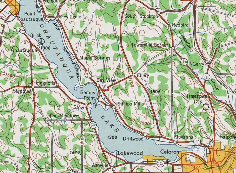
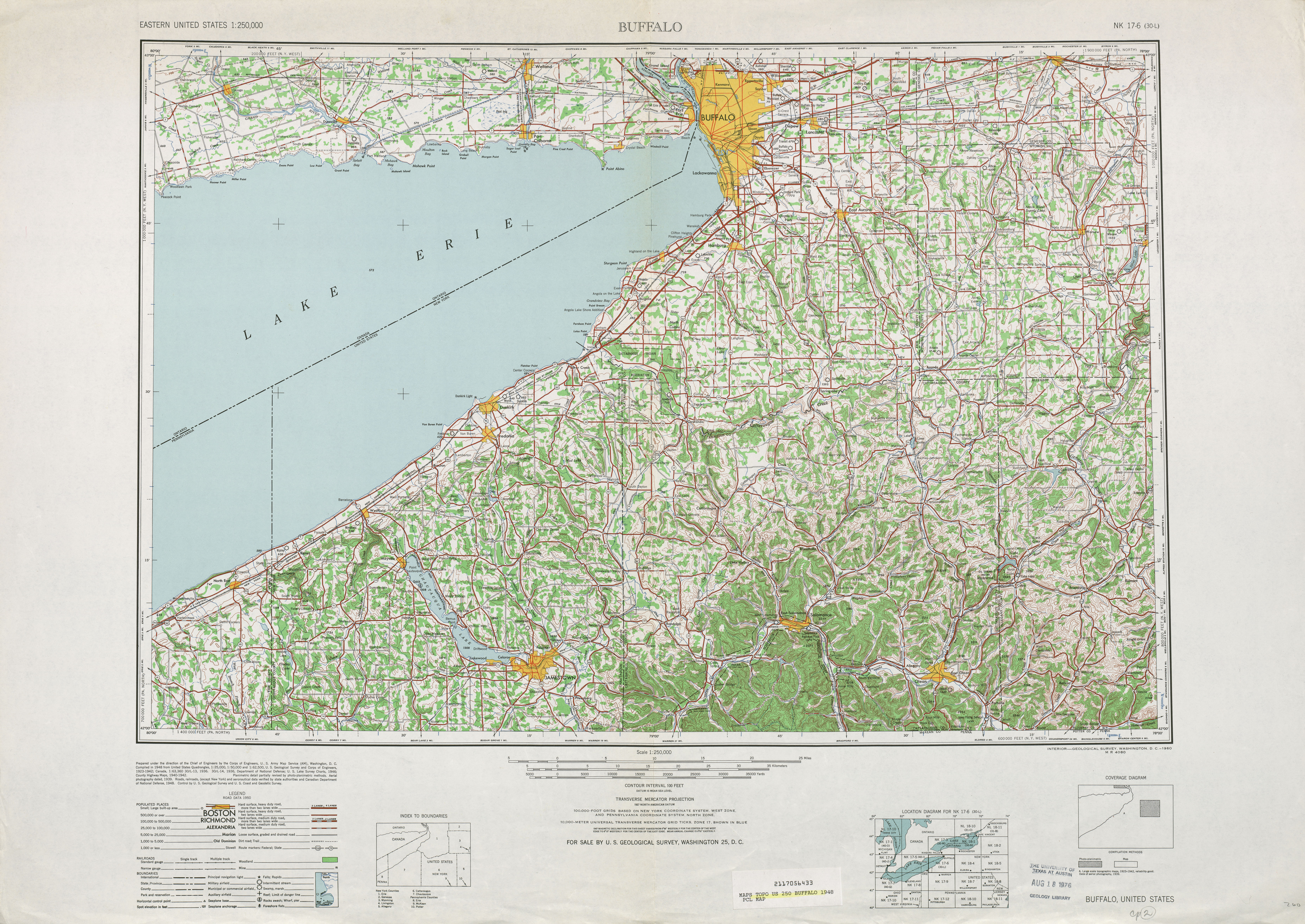
| Description | 1948 topographic quadrangle of former New York State Route 17J |
| Date | |
| Source | Library at the university of Texas using United States Geological Survey topographic maps |
| Author | United states geological survey (edited by Mitchazenia) |
Licensing
This image is in the public domain in the United States because it only contains materials that originally came from the United States Geological Survey, an agency of the United States Department of the Interior. For more information, see the official USGS copyright policy. |
File history
Click on a date/time to view the file as it appeared at that time.
| Date/Time | Thumbnail | Dimensions | User | Comment | |
|---|---|---|---|---|---|
| current | 21:49, 24 March 2008 | | 794 × 581 (1.1 MB) | Mitchazenia | {{Information |Description=1948 topographic quadrangle of former New York State Route 17J |Source=[http://www.lib.utexas.edu/maps/topo/250k/txu-pclmaps-topo-us-buffalo-1948.jpg Library at the university of Texas using United States Geological Survey topog |
File usage
The following pages on the English Wikipedia use this file (pages on other projects are not listed):
Global file usage
The following other wikis use this file:
- Usage on de.wikipedia.org
- Usage on pt.wikipedia.org
- Usage on www.wikidata.org
🔥 Top keywords: Main PageSpecial:SearchPage 3Wikipedia:Featured picturesHouse of the DragonUEFA Euro 2024Bryson DeChambeauJuneteenthInside Out 2Eid al-AdhaCleopatraDeaths in 2024Merrily We Roll Along (musical)Jonathan GroffJude Bellingham.xxx77th Tony AwardsBridgertonGary PlauchéKylian MbappéDaniel RadcliffeUEFA European Championship2024 ICC Men's T20 World CupUnit 731The Boys (TV series)Rory McIlroyN'Golo KantéUEFA Euro 2020YouTubeRomelu LukakuOpinion polling for the 2024 United Kingdom general electionThe Boys season 4Romania national football teamNicola CoughlanStereophonic (play)Gene WilderErin DarkeAntoine GriezmannProject 2025