

Original file (SVG file, nominally 400 × 600 pixels, file size: 1.17 MB)
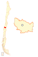
| DescriptionMapa loc Ñuble.svg | Español: Mapa localizador de la XVI Región del Ñuble |
| Date | |
| Source | This file was derived from: Mapa loc Biobío.svg by B1mbo |
| Author | derivative work: Janitoalevic |
Click on a date/time to view the file as it appeared at that time.
| Date/Time | Thumbnail | Dimensions | User | Comment | |
|---|---|---|---|---|---|
| current | 22:52, 5 September 2018 | | 400 × 600 (1.17 MB) | Janitoalevic | . |
| 22:47, 5 September 2018 |  | 400 × 600 (756 KB) | Janitoalevic | . | |
| 23:04, 24 July 2017 |  | 427 × 640 (986 KB) | Janitoalevic | . | |
| 02:53, 6 July 2017 |  | 427 × 640 (986 KB) | Janitoalevic | . | |
| 01:38, 18 July 2016 |  | 400 × 600 (1.12 MB) | Janitoalevic | User created page with UploadWizard |
The following other wikis use this file:
This file contains additional information, probably added from the digital camera or scanner used to create or digitize it.
If the file has been modified from its original state, some details may not fully reflect the modified file.
| Width | 400 |
|---|---|
| Height | 600 |