

Original file (SVG file, nominally 1,003 × 443 pixels, file size: 1.44 MB)
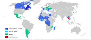
| DescriptionMap-Francophonie organisation en.svg | English: Map of the International Organisation of the Francophonie Français : Carte de l'Organisation internationale de la Francophonie 日本語: フランコフォニー国際機関の加盟国と関連する国 |
| Date | |
| Source | File:Map-Francophonie organisation fr.svg |
| Author | Bourrichon; derivative work Giorgi Balakhadze |
| Other versions |
|
| Public domainPublic domainfalsefalse |
| I, the copyright holder of this work, release this work into the public domain. This applies worldwide. In some countries this may not be legally possible; if so: I grant anyone the right to use this work for any purpose, without any conditions, unless such conditions are required by law. |
Click on a date/time to view the file as it appeared at that time.
| Date/Time | Thumbnail | Dimensions | User | Comment | |
|---|---|---|---|---|---|
| current | 00:52, 21 September 2019 | | 1,003 × 443 (1.44 MB) | Simtropolitan | +Louisiana |
| 13:20, 25 November 2018 |  | 1,003 × 443 (1.34 MB) | Giorgi Balakhadze | User created page with UploadWizard |
More than 100 pages use this file.The following list shows the first 100 pages that use this file only.A full list is available.
View more links to this file.
The following other wikis use this file:
This file contains additional information, probably added from the digital camera or scanner used to create or digitize it.
If the file has been modified from its original state, some details may not fully reflect the modified file.
| Width | 1002.6667 |
|---|---|
| Height | 442.66666 |

