
Original file (2,064 × 1,280 pixels, file size: 1.45 MB, MIME type: image/jpeg)
This image is very small, unfixably too light/dark, or may not adequately illustrate the subject of the image If a higher-quality version of this particular image is available, please replace this one; otherwise, a supplemental image illustrating this subject and available under a free license should be found or provided and uploaded as a separate file. Please see Category:Image cleanup templates for templates used to mark images that only need a clean-up. For more help, see Commons:Media for cleanup#Low quality images. العربية ∙ беларуская (тарашкевіца) ∙ català ∙ čeština ∙ Deutsch ∙ English ∙ español ∙ فارسی ∙ suomi ∙ français ∙ galego ∙ magyar ∙ italiano ∙ 日本語 ∙ ಕನ್ನಡ ∙ 한국어 ∙ македонски ∙ മലയാളം ∙ Plattdüütsch ∙ Nederlands ∙ norsk ∙ polski ∙ português ∙ русский ∙ sicilianu ∙ slovenščina ∙ svenska ∙ Tiếng Việt ∙ 中文 ∙ 中文(简体) ∙ 中文(繁體) ∙ 中文(臺灣) ∙ +/− |
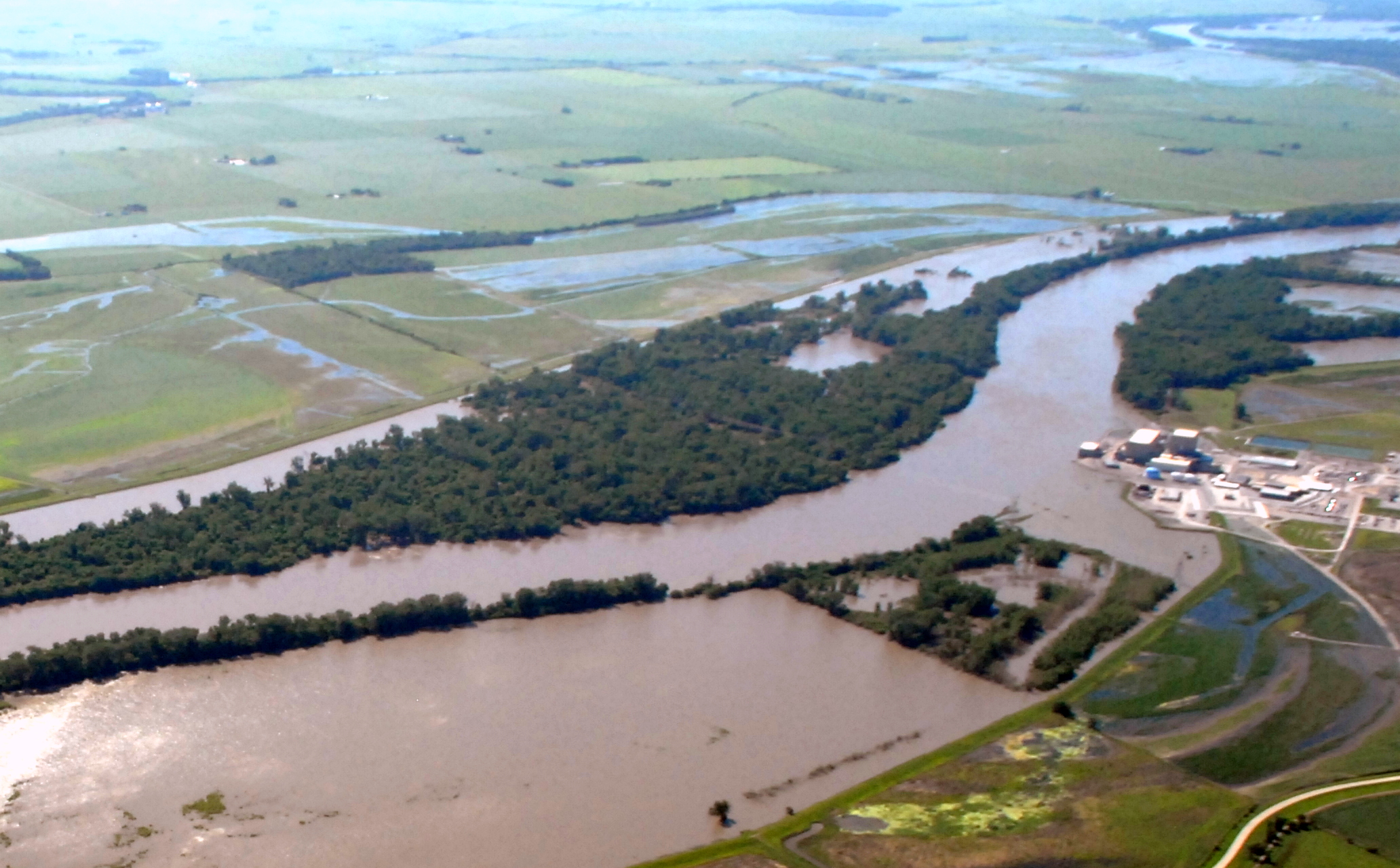
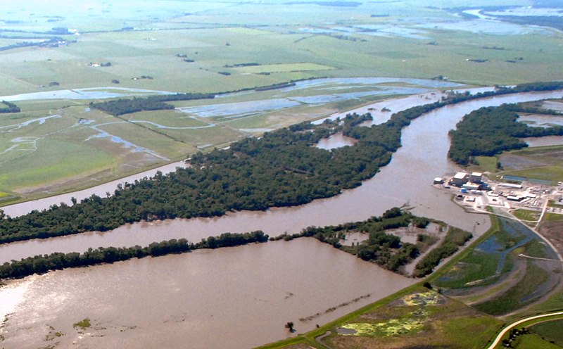
| DescriptionCorp of Eng. 6-15-11 108.jpg | English: Cooper Nuclear Power Plant on the edge of the 2011 Missouri River Floods on June 15, 2011 |
| Date | |
| Source | http://www.nwo.usace.army.mil/html/op-e/Photos/Mo%20River%20Rulo%20to%20Blair%2015%20June%202011/NE-PlatteRiv-Rulo.pdf |
| Author | U.S. Army Corp of Engineers |
| Camera location | 40° 23′ 18″ N, 95° 40′ 17.4″ W | View this and other nearby images on: OpenStreetMap |
|---|
| Public domainPublic domainfalsefalse |
This file is a work of a U.S. Army soldier or employee, taken or made as part of that person's official duties. As a work of the U.S. federal government, it is in the public domain in the United States. العربية ∙ বাংলা ∙ català ∙ čeština ∙ Deutsch ∙ English ∙ español ∙ eesti ∙ فارسی ∙ suomi ∙ français ∙ hrvatski ∙ magyar ∙ Bahasa Indonesia ∙ italiano ∙ 日本語 ∙ 한국어 ∙ lietuvių ∙ македонски ∙ മലയാളം ∙ မြန်မာဘာသာ ∙ Nederlands ∙ polski ∙ português ∙ русский ∙ sicilianu ∙ српски / srpski ∙ Türkçe ∙ українська ∙ Tiếng Việt ∙ 中文(简体) ∙ 中文(繁體) ∙ +/− |  |
Click on a date/time to view the file as it appeared at that time.
| Date/Time | Thumbnail | Dimensions | User | Comment | |
|---|---|---|---|---|---|
| current | 04:20, 22 June 2011 | | 2,064 × 1,280 (1.45 MB) | Americasroof |
The following other wikis use this file:
This file contains additional information, probably added from the digital camera or scanner used to create or digitize it.
If the file has been modified from its original state, some details may not fully reflect the modified file.
| Camera manufacturer | NIKON CORPORATION |
|---|---|
| Camera model | NIKON D200 |
| Exposure time | 1/2,500 sec (0.0004) |
| F-number | f/7.1 |
| ISO speed rating | 400 |
| Date and time of data generation | 09:49, 15 June 2011 |
| Lens focal length | 22 mm |
| Altitude | 1,172 meters above sea level |
| Horizontal resolution | 300 dpi |
| Vertical resolution | 300 dpi |
| Software used | Ver.1.00 |
| File change date and time | 09:49, 15 June 2011 |
| Y and C positioning | Co-sited |
| Exposure Program | Aperture priority |
| Exif version | 2.21 |
| Date and time of digitizing | 09:49, 15 June 2011 |
| Image compression mode | 4 |
| Exposure bias | 0 |
| Maximum land aperture | 3.8 APEX (f/3.73) |
| Metering mode | Center weighted average |
| Light source | Unknown |
| Flash | Flash did not fire |
| DateTime subseconds | 24 |
| DateTimeOriginal subseconds | 24 |
| DateTimeDigitized subseconds | 24 |
| Color space | sRGB |
| Sensing method | One-chip color area sensor |
| Custom image processing | Normal process |
| Exposure mode | Auto exposure |
| White balance | Auto white balance |
| Digital zoom ratio | 1 |
| Focal length in 35 mm film | 33 mm |
| Scene capture type | Standard |
| Contrast | Normal |
| Saturation | Normal |
| Sharpness | Normal |
| Subject distance range | Unknown |
| Unique image ID | 5895d9f82b8049d8c8b999cedfe97012 |
| North or south latitude | North latitude |
| East or west longitude | West longitude |
| Satellites used for measurement | 06 |
| Geodetic survey data used | WGS 84 |
| GPS date | 15 June 2011 |