

Original file (2,048 × 1,536 pixels, file size: 1.79 MB, MIME type: image/jpeg)
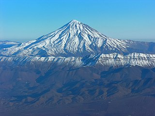
| DescriptionAerial View of Damavand 26.11.2008 04-25-38.JPG | Aerial View of Damavand |
| Date | Taken on 26 November 2008, 04:25:38 |
| Source | Own work |
| Author | Hansueli Krapf |
| Permission (Reusing this file) | Attribution ShareAlike 3.0 |
| Camera location | 35° 27′ 00.4″ N, 52° 05′ 49.01″ E | View this and other nearby images on: OpenStreetMap |
|---|
| Annotations InfoField | This image is annotated: View the annotations at Commons |
Mount Doberar
Mount Damavand
Click on a date/time to view the file as it appeared at that time.
| Date/Time | Thumbnail | Dimensions | User | Comment | |
|---|---|---|---|---|---|
| current | 15:50, 29 December 2012 | | 2,048 × 1,536 (1.79 MB) | Simisa | Changed color temperature |
| 19:47, 19 June 2009 |  | 2,048 × 1,536 (928 KB) | Simisa | {{Information |Description=Aerial View of Damavand |Source=Own Work |Date=see metadata |Author=Hansueli Krapf |Permission=Attribution ShareAlike 3.0 |other_versions= }} {{cc-by-sa-3.0}} Category:Aerial photographs of Iran [[Category: |
The following other wikis use this file:
View more global usage of this file.
This file contains additional information, probably added from the digital camera or scanner used to create or digitize it.
If the file has been modified from its original state, some details may not fully reflect the modified file.
| Camera manufacturer | NIKON |
|---|---|
| Camera model | E8800 |
| Exposure time | 289,687/50,000,000 sec (0.00579374) |
| F-number | f/6.9 |
| ISO speed rating | 50 |
| Date and time of data generation | 04:25, 26 November 2008 |
| Lens focal length | 40 mm |
| Latitude | 35° 27′ 0.4″ N |
| Longitude | 52° 5′ 49.01″ E |
| Altitude | 5,222 meters above sea level |
| Orientation | Normal |
| Horizontal resolution | 300 dpi |
| Vertical resolution | 300 dpi |
| Software used | Capture NX 2.3.5 W |
| File change date and time | 16:46, 29 December 2012 |
| Y and C positioning | Centered |
| Exposure Program | Normal program |
| Exif version | 2.2 |
| Date and time of digitizing | 04:25, 26 November 2008 |
| Meaning of each component |
|
| Exposure bias | 0 |
| Maximum land aperture | 3.1 APEX (f/2.93) |
| Metering mode | Pattern |
| Light source | Unknown |
| Flash | Flash did not fire, compulsory flash suppression |
| Supported Flashpix version | 1 |
| Color space | Uncalibrated |
| File source | Digital still camera |
| Scene type | A directly photographed image |
| Custom image processing | Normal process |
| Exposure mode | Auto exposure |
| White balance | Auto white balance |
| Digital zoom ratio | 0 |
| Focal length in 35 mm film | 157 mm |
| Scene capture type | Standard |
| Scene control | None |
| Contrast | Normal |
| Saturation | Normal |
| Sharpness | Normal |
| Subject distance range | Unknown |
| Geodetic survey data used | WGS-84 |
| GPS tag version | 0.0.2.2 |
| Keywords |
|
| Code for country shown | IRN |
| Sublocation of city shown | Aḩmadābād-e Khāk Tappeh |
| Country shown | Iran |
| Province or state shown | Semnān |
| IIM version | 4 |