

Original file (SVG file, nominally 810 × 810 pixels, file size: 43 KB)
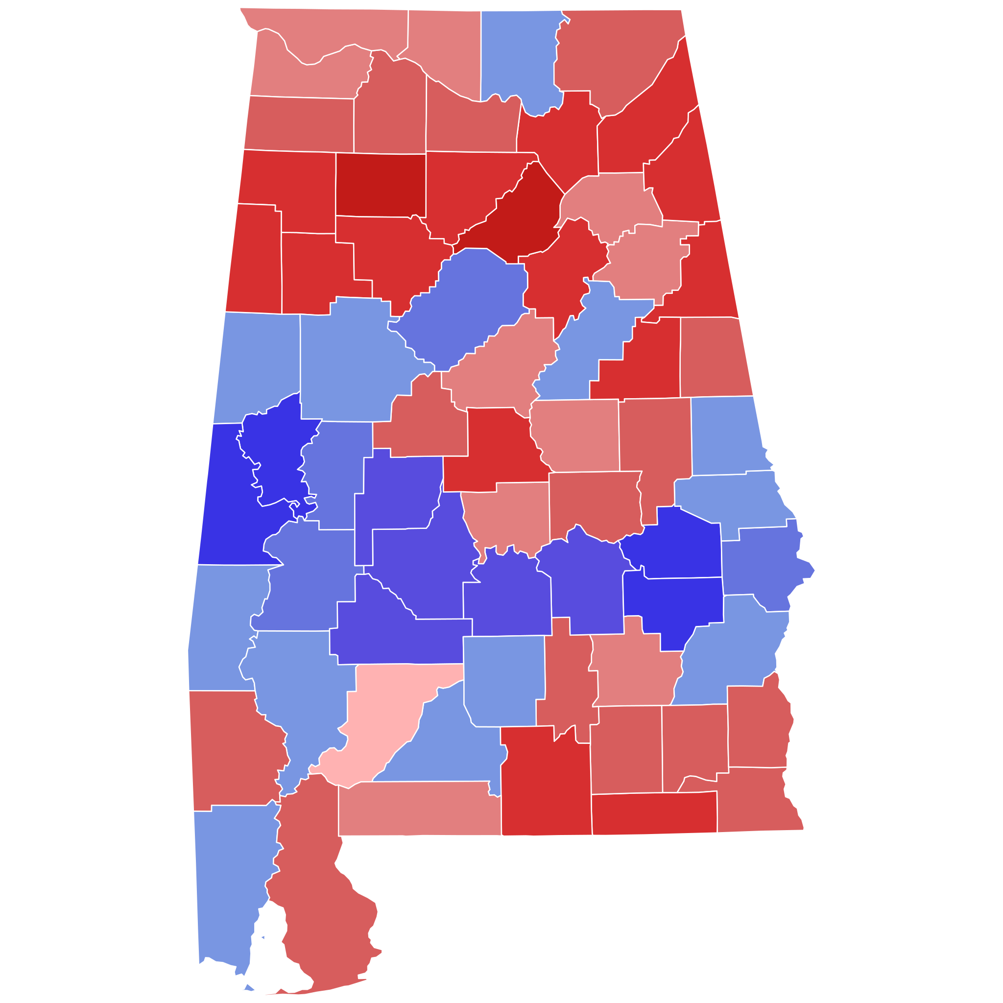
| Description2017 United States Senate special election in Alabama results map by county.svg | Percentage of the vote each candidate took in the 2017 U.S. Senate special election in Alabama by county. Data used to create map is from Politico. Moore Jones
|
| Date | |
| Source | Own work |
| Author | WClarke |
Click on a date/time to view the file as it appeared at that time.
| Date/Time | Thumbnail | Dimensions | User | Comment | |
|---|---|---|---|---|---|
| current | 16:08, 21 June 2023 | | 810 × 810 (43 KB) | Putitonamap98 | shapes |
| 10:55, 30 December 2022 |  | 744 × 744 (329 KB) | Putitonamap98 | Reverted to version as of 10:55, 30 December 2022 (UTC) | |
| 10:55, 30 December 2022 |  | 744 × 744 (329 KB) | Putitonamap98 | Reverted to version as of 10:38, 30 December 2022 (UTC) | |
| 10:55, 30 December 2022 |  | 744 × 744 (329 KB) | Putitonamap98 | shapes | |
| 10:38, 30 December 2022 |  | 744 × 744 (329 KB) | Putitonamap98 | Reverted to version as of 11:40, 25 December 2022 (UTC) | |
| 00:59, 30 December 2022 |  | 139 × 223 (43 KB) | HoustonFootball | Reverted to version as of 19:05, 29 July 2018 (UTC) | |
| 11:40, 25 December 2022 |  | 744 × 744 (329 KB) | Putitonamap98 | shapes | |
| 19:05, 29 July 2018 |  | 139 × 223 (43 KB) | Count Awesome | Standardized format for Alabama Senate map would be thicker lines serving as boundaries between counties | |
| 16:15, 7 April 2018 |  | 139 × 223 (40 KB) | Kingofthedead | Reverted to version as of 04:19, 27 January 2018 (UTC) | |
| 22:35, 6 April 2018 |  | 139 × 223 (43 KB) | Count Awesome | Reverted to version as of 04:32, 23 January 2018 (UTC) |
The following other wikis use this file:
This file contains additional information, probably added from the digital camera or scanner used to create or digitize it.
If the file has been modified from its original state, some details may not fully reflect the modified file.
| Width | 810 |
|---|---|
| Height | 810 |