Bamban, officially the Municipality of Bamban (Kapampangan: Balen ning Bamban; Filipino: Bayan ng Bamban), is a 2nd class municipality in the province of Tarlac, Philippines. According to the 2020 census, it has a population of 78,260 people.[3]
Bamban | |
|---|---|
| Municipality of Bamban | |
 Panoramic of Bamban | |
 Flag  Seal | |
 Map of Tarlac with Bamban highlighted | |
OpenStreetMap  | |
.svg) Bamban Location within the Philippines | |
| Coordinates: 15°16′27″N 120°34′01″E / 15.2742°N 120.5669°E | |
| Country | Philippines |
| Region | Central Luzon |
| Province | Tarlac |
| District | 3rd district |
| Founded | June 6, 1710 |
| Barangays | 15 (see Barangays) |
| Government | |
| • Type | Sangguniang Bayan |
| • Mayor | Alice Guo (suspended) Leonardo Anunciacion (Officer in Charge) |
| • Vice Mayor | Leonardo Anunciacion |
| • Representative | Noel N. Rivera |
| • Municipal Council | Members |
| • Electorate | 45,008 voters (2022) |
| Area | |
| • Total | 251.98 km2 (97.29 sq mi) |
| Elevation | 89 m (292 ft) |
| Highest elevation | 265 m (869 ft) |
| Lowest elevation | 48 m (157 ft) |
| Population (2020 census)[3] | |
| • Total | 78,260 |
| • Density | 310/km2 (800/sq mi) |
| • Households | 17,695 |
| Economy | |
| • Income class | 2nd municipal income class |
| • Poverty incidence | 13.47 |
| • Revenue | ₱ 244.7 million (2020) |
| • Assets | ₱ 521.7 million (2020) |
| • Expenditure | ₱ 246.1 million (2020) |
| • Liabilities | ₱ 79.01 million (2020) |
| Service provider | |
| • Electricity | Tarlac 2 Electric Cooperative (TARELCO 2) |
| Time zone | UTC+8 (PST) |
| ZIP code | 2317, 2023 (portions under Clark Freeport and Special Economic Zone) |
| PSGC | |
| IDD : area code | +63 (0)45 |
| Native languages | Kapampangan Tagalog Ilocano |
| Website | bambantarlac |
Etymology
The municipality derives its name from the bamban plants (Donax canniformis) that once dominated large areas of land along the river near the foothills. It was initially called cabambanan or mabamban, but was later called simply as bamban.[5]
History
The site of Bamban was originally a vast track of wild land extending eastward; and on the west side, composed of forested foothills and mountains lush with tall trees extending deep into the Zambales ranges. The thick forest and mountains were then inhabited by the Aetas (locally known as Baluga), and the Zambal, both of whom subsisted only on fishing and native or wild animals which abounded in the place. Occasionally, traders from Pampanga and the Tagalog provinces braved the wilderness to go northward to Capas and Tarlac.
Before the advent of the Spanish era, small settlers came, attracted by the fertile land sustained by the river. The settlers started small clearings in the thick growth of bamban plants which covered vast portions of the land bordering the river a small distance from the foothills. Because of these plants, the place was eventually named Bamban. About 1700, Augustinian Recollects came and established the Mission de Pueblos de Bamban. Originally a part of Pampanga, in 1837, a new boundary line was established, thereby permanently making Bamban part of the province of Tarlac.
Official recognition as a town was sanctioned by the gobernadorcillos in Tarlac town. Don Martín Sibal was subsequently appointed head and commissioned with the rank of "Capitán". Among the first settlers were the Sibal, Lugtu, Dayrit, Macale, Vergara, Manipon, and de la Cruz clans.

During the revolution of 1896, Bamban was one of the first towns to take up arms against the Spaniards. Northwest of the town situated among the hills are remnants of strongholds built by Bambanenses who joined Gen. Servillano Aquino in the uprising in Tarlac. Up to this time, a portion of the foothills in the area is called "Batiawan" or look-out point.
When the Americans came in 1900, the pueblo gradually grew into a town. The Bamban Sugar Central was established. Don Pablo Lagman was the first to be appointed presidente and Don Laureano Campo as vice-presidente under the American military government. Other prominent families then took over the helm of government. During the Commonwealth era, the Sibals, the Lumboys, the Santoses, the Punsalangs, to mention a few, enjoyed political power until the outbreak of World War II. The whole población was devastated and burned during the liberation. Rebuilding began despite the ongoing fighting in the mountains. Growth was fast because of proximity of Clark Air Base. However, prominent families left the town for the city to establish big business and names for themselves.
The 1991 Mount Pinatubo volcanic eruption and the subsequent flow of lahar to the lowlands of Bamban forced residents to move out or to stay at the Dapdap Resettlement Area, which is on higher grounds.
Geography
Bamban is the southernmost town of Tarlac. It has a common boundary with Mabalacat, Pampanga, and in the west, with Zambales. The boundary is defined by the Parua River, which is a source of irrigation water, food, and sand and gravel for infrastructure projects. The mountainous region situated in the western part comprises almost two-thirds of the total land area, which used to be within the US Military Reservations. Nestled in this part are the BLISS projects and to the north, the MAR settlement project.
Bamban is 99 kilometers (62 mi) from Manila and is 25 kilometers (16 mi) from the provincial capital, Tarlac City.
Barangays

Bamban is politically subdivided into 15 barangays. [6] Each barangay consists of puroks and some have sitios.
- Anupul
- Banaba
- Bangcu
- Culubasa
- Dela Cruz
- La Paz
- Lourdes
- Malonzo
- San Nicolas (poblacion)
- San Pedro
- San Rafael
- San Roque
- San Vicente
- Santo Niño
- Lumang kalsada
- Virgen de los Remedios (Pacalcal)
Climate
| Climate data for Bamban, Tarlac | |||||||||||||
|---|---|---|---|---|---|---|---|---|---|---|---|---|---|
| Month | Jan | Feb | Mar | Apr | May | Jun | Jul | Aug | Sep | Oct | Nov | Dec | Year |
| Mean daily maximum °C (°F) | 30 (86) | 31 (88) | 33 (91) | 35 (95) | 33 (91) | 31 (88) | 30 (86) | 29 (84) | 29 (84) | 30 (86) | 31 (88) | 30 (86) | 31 (88) |
| Mean daily minimum °C (°F) | 19 (66) | 19 (66) | 20 (68) | 22 (72) | 24 (75) | 24 (75) | 24 (75) | 24 (75) | 23 (73) | 22 (72) | 21 (70) | 20 (68) | 22 (71) |
| Average precipitation mm (inches) | 3 (0.1) | 2 (0.1) | 5 (0.2) | 10 (0.4) | 80 (3.1) | 107 (4.2) | 138 (5.4) | 147 (5.8) | 119 (4.7) | 70 (2.8) | 26 (1.0) | 8 (0.3) | 715 (28.1) |
| Average rainy days | 2.0 | 1.7 | 2.7 | 4.6 | 16.1 | 20.8 | 24.0 | 23.0 | 21.4 | 15.5 | 8.0 | 3.2 | 143 |
| Source: Meteoblue[7] | |||||||||||||
Demographics
|
| |||||||||||||||||||||||||||||||||||||||||||||||||||
| Source: Philippine Statistics Authority[8][9][10][11] | ||||||||||||||||||||||||||||||||||||||||||||||||||||
In the 2020 census, the population of Bamban, was 78,260 people,[3] with a density of 310 inhabitants per square kilometer or 800 inhabitants per square mile.
Economy
Poverty incidence of Bamban
2.5 5 7.5 10 12.5 15 2006 7.60 2009 10.60 2012 4.61 2015 12.56 2018 10.30 2021 13.47 Source: Philippine Statistics Authority[12][13][14][15][16][17][18][19] |
Tourism

- At the center of the town is the heritage Santo Niño Parish Church of Bamban,[20] (Vicariate of San Nicolas de Tolentino; Vicar Forane: Msgr. Francisco Tañedo[21][22][23] which was founded in 1812.
- Titular: Santo Niño, Feast, Last Saturday of January.
- Grotto of Our Lady of Lourdes of Bamban at Dolores
- Bamban Caves and the Matayumtayum well was used by General Francisco Makabulos and his troops against the Spaniards and later on by Filipino guerrillas during the Second World War.
Gallery
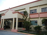 Bamban municipal hall
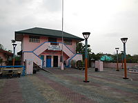 Municipal library, town plaza and police station
 Public market
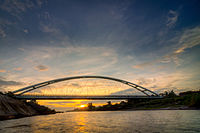 Bamban Bridge
 Highway


.jpg)
