

Původní soubor (soubor SVG, nominální rozměr: 1 091 × 1 042 pixelů, velikost souboru: 194 KB)
Usage of this file with:

explanatory notes: Legally binding is only the full legalcode. For a free usage I recommend to respect the following licence conditions:
1. Provide my name as given above: NordNordWest,
2. a copy of, or the URI for, the applicable license: https://creativecommons.org/licenses/by-sa/3.0/de/legalcode,
3. the title of the work,
4. in the case of an adaptation, a credit identifying the use of the work in the adaptation.
This license and the rights granted hereunder will terminate automatically upon any breach by you of the terms of this license. Any of the above conditions can be waived if you get permission from the copyright holder. If you have questions or wish differing conditions, please contact me through nnwest or my discussion page ![]() t-online.de
t-online.de

Kliknutím na datum a čas se zobrazí tehdejší verze souboru.
| Datum a čas | Náhled | Rozměry | Uživatel | Komentář | |
|---|---|---|---|---|---|
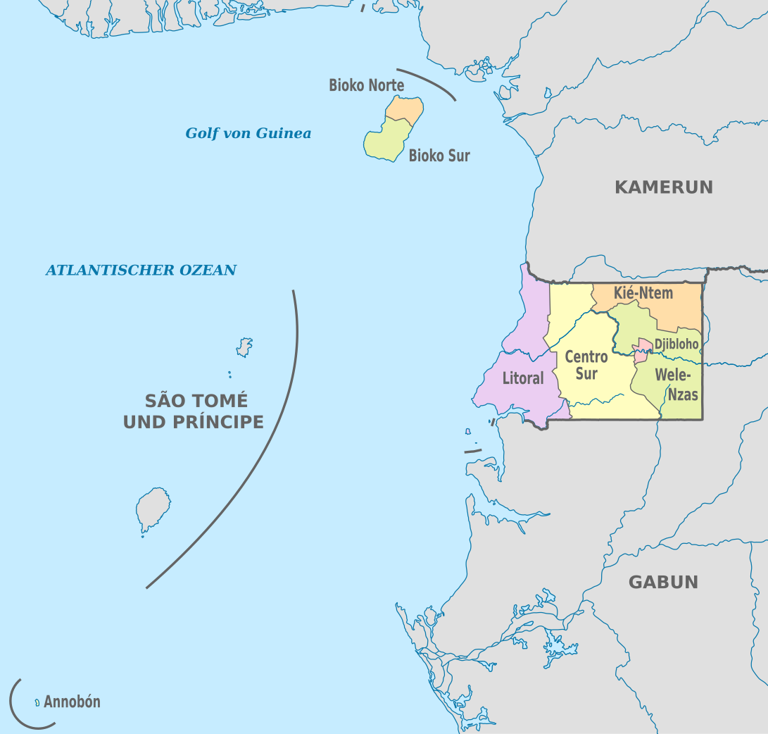
| současná | 25. 11. 2020, 21:53 | | 1 091 × 1 042 (194 KB) | NordNordWest | == {{int:filedesc}} == {{Information |Description={{de|Karte der politischen Gliederung von Äquatorialguinea, Stand 2020}} {{en|Map of the administrative divisions of Equatorial Guinee}} |Source={{own}} |date=2020-11-25 |author={{U|NordNordWest}} |permission= |other_versions={{SVG labeled maps of administrative divisions (location map scheme)}} }} == {{int:license-header}} == {{User:NordNordWest/LicenceMap}} [[Category:SVG labeled maps of administrative divisions of Equatorial Guinea (locat... |
Tento soubor používá následující stránka:
Tento soubor využívají následující wiki:
Tento soubor obsahuje dodatečné informace, poskytnuté zřejmě digitálním fotoaparátem nebo scannerem, kterým byl pořízen. Pokud byl soubor od té doby změněn, některé údaje mohou být neplatné.
| Šířka | 1091.322px |
|---|---|
| Výška | 1041.744px |


.svg)


_(Paris_zoom).svg)
.svg)
,_administrative_divisions_-_de_-_colored_(multizoom).svg)
_-_colored.svg)
.svg)
,_administrative_divisions_-_Nmbrs_(multizoom).svg)
,_administrative_divisions_-_de_-_colored.svg)
_-_de_-_colored.svg)

.svg)

.svg)