Independence County, Arkansas
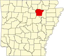
Independence County[1] is a Beziak im Bundesstoot Arkansas in da USA. Da Beziak hod 36.647 Eihwohna. Da Sitz vo da Vawoitung is Batesville.
| Vawoitung | |
|---|---|
| US-Bundesstoot: | Arkansas |
| Sitz vo da Vawoitung: | Batesville |
| Adress vom Vawoitungssitz: | County Courthouse 192 East Main Street Batesville, AR 72501-5508 |
| Grindung: | 1820 |
| Buidt aus: | Arkansas County Lawrence County |
| Vuawoi: | 001 870 |
| Demographie | |
| Eihwohna: | 36.647 (2010) |
| Dichtn: | 18,5 Eihwohna/km² |
| Eadkund | |
| Flächn gesamt: | 1.998 km² |
| Wossaflächn: | 20 km² |
| Koartn | |
 | |
| Hoamseitn: www.independencecounty.com | |
Da Beziak hod a Fläche vo 1998 Quadratkilometa, dovo san 20 Quadratkilometa Wossafläche.
Gmoana
Citys
| Towns
|
|
|
|
|
1 - teiweis im Sharp County
- weitare Oate
- Bailey
- Bethesda
- Big Spring Mill
- Cedar Grove
- Collietown
- Cushman Junction
- Dennison Heights
- Dota
- Dowdy
- Dunnington
- Earnheart
- Elmo
- Gainsboro
- Harmontown
- Hazel Grove
- Hickory Valley
- Huff
- Hutchinson
- Jamestown
- Limedale
- Limedale Junction
- Lockheart
- Maple Springs
- McHue
- Mount Carmel
- New Hope
- O'Neal
- Paroquet
- Pattonville
- Rutherford
- Sandtown
- Simmons
- The Quarry
- Union Hill
- Walnut Grove
Townships
- Ashley Township
- Barren Township
- Big Bottom Township
- Black River Township
- Cushman Township
- Departee Township
- Dota Township
- Fairview Township
- Gainsboro Township
- Greenbrier Township
- Hill Township
- Huff Township
- Jefferson Township
- Liberty Township
- Logan Township
- Magness Township
- Marshell Township
- McHue Township
- Moorefield Township
- Oil Trough Township
- Relief Township
- Rosie Township
- Ruddell Township
- Salado Township
- Union Township
- Washington Township
- White River Township
- Wycough Township
Beleg
Countys in Arkansas |
